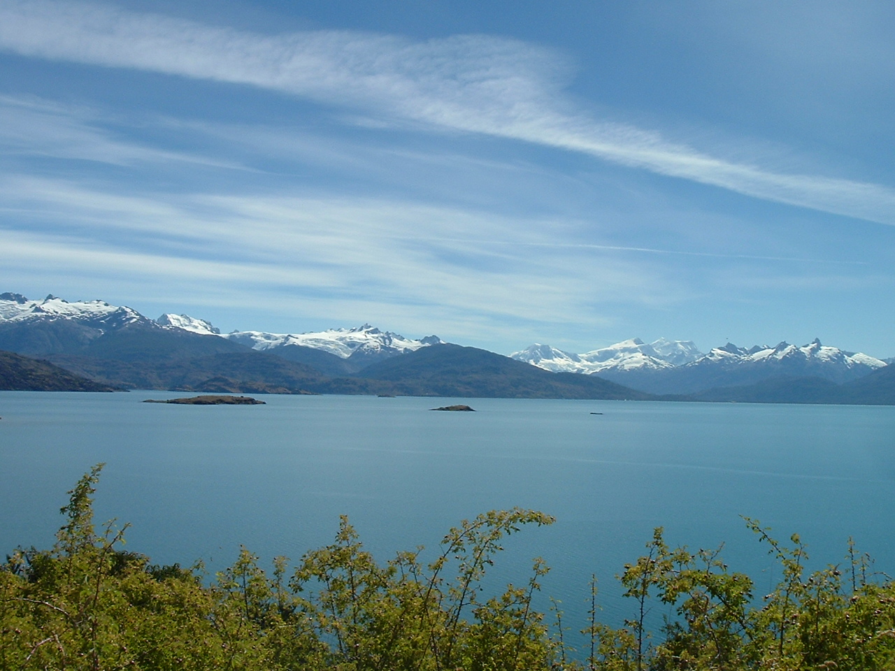
Laguna San Rafael National Park
47.0000° S · 74.0000° W · National Park
Photo: Jorge Morales Piderit · Public domain · Wikimedia Commons
Laguna San Rafael National Park is a national park in Chile. Declared a Chilean national park in 1959. The free Lokali audio guide runs 7 minutes.
✓ Published October 2026 · how we write these guides
Visitor facts
| Lokali audio guide | 7 min · free |
|---|---|
| Type | National Park |
| Location | Aysén, Chile |
| Coordinates | -47.0000, -74.0000 |
| Official website | conaf.cl |
| Languages | 50+, in the Lokali app |
The story
Listen first. Before you look at anything, just listen. Somewhere across the water there is a deep crack, like a door slamming in a stone house. Then comes a long, low rumble that rolls over the lagoon and fades into the mountains. The air is cold and clean, and it smells of wet rock and salt. Small pieces of ice knock gently against the hull. This is the sound of a glacier breaking apart, and it is the heartbeat of Laguna San Rafael.
You are deep in the Aysén region of Chilean Patagonia. This is one of the wettest, wildest and least populated corners of South America. There are no roads to this lagoon. Almost every visitor arrives the way you probably did — by boat, through narrow channels and fjords, or by a small plane landing on a remote airstrip. That isolation is a big part of why the park still feels the way it does. Very little here was built for people.
Chile declared this a national park in 1959. Twenty years later, UNESCO recognised it as a biosphere reserve. The park is enormous. It is one of the largest protected areas in the whole country. It covers mountains, rainforest, islands, coastline and a huge plateau of ice. Most of that land has no trails at all. What you see from the water is only a thin edge of something much bigger.
That bigger thing is the Northern Patagonian Ice Field. It is a vast sheet of ice that sits on top of the Andes, hundreds of metres thick in places. Snow falls on it constantly, carried in by storms from the Pacific. Over many years, the snow is pressed down into dense ice. Then gravity pulls that ice outward, down the valleys, in rivers of ice called glaciers. The San Rafael Glacier, in front of you, is one of those rivers.
Look at the face of the glacier. It ends in a wall of ice that rises straight out of the lagoon. Up close, it is far taller than it seems from a distance, because there is nothing nearby to give you scale. The colour changes as you look. Some sections are bright white. Others are a deep, almost electric blue. That blue is not a trick of the light. Very dense, old ice absorbs the red part of sunlight, and the blue part passes through.
Now watch for movement. A glacier that meets water is called a tidewater glacier, and it loses ice by calving. Huge blocks break from the front and fall into the lagoon. Sometimes you see the fall first and hear it a few seconds later, because sound travels slower than light. The waves that follow can rock even a large boat. This is why captains keep a careful distance from the ice wall.
The ice that falls does not disappear quickly. It floats around the lagoon as icebergs, in every size and shape. Some are as small as a suitcase. Others are as large as a house. Look carefully at their surfaces. Many are carved into ridges and hollows by wind and melting water. Some have flipped over, showing smooth, glassy undersides. A few carry dark stripes of rock and gravel, picked up as the ice scraped down the mountain.
Here is something many visitors do not realise. This glacier has been retreating for a long time. Explorers and scientists who came here in the nineteenth century described the ice reaching much further into the lagoon than it does today. Over the twentieth century, the front pulled back by several kilometres. Researchers study San Rafael closely because it shows, very clearly, how glaciers respond to a changing climate. What you are watching is not frozen in place. It is changing within a human lifetime.
The lagoon itself is a strange body of water. It is connected to the sea by a narrow channel called the Río Témpanos — the River of Icebergs. Tides push salt water in and out, so the lagoon mixes seawater with fresh meltwater from the glacier. On a calm day, the surface can be so still that it holds a perfect reflection of the mountains. On a rough day, wind drives the icebergs together into crowded, grinding fields.
There is a second surprise just south of here. A thin neck of land, the Isthmus of Ofqui, separates this area from the Gulf of Penas to the south. In the twentieth century, Chile began digging a canal across it, hoping to give ships a sheltered route that avoided the open, stormy Pacific. The project was never finished. Parts of that abandoned canal are still there, slowly being taken back by the forest. It is a quiet reminder of how hard this landscape is to change.
Turn your eyes to the shoreline. The forest grows thick and dark, right down to the water. This is temperate rainforest, fed by heavy rain for most of the year. Moss and ferns cover almost every surface. Above the forest, the peaks rise into cloud. The highest mountain in the park, Monte San Valentín, is also the highest peak in Patagonia. On clear days you may catch sight of it, but it often hides behind weather.
Keep watching the water and the sky. Seabirds follow the boats and circle over the ice. Cormorants sometimes rest on the floating icebergs. Sea lions and dolphins live in the channels that lead here, and sharp-eyed passengers often spot them on the way in or out. On many boats, there is also a cheerful local custom. The crew fishes a piece of glacier ice from the lagoon and serves it in a drink. Ice that may be very old, melting in your glass.
Before you leave, take one more slow look around you. Notice how quiet it is between the falls of ice. Notice the light on the water, and how the blue of the glacier shifts as clouds pass over. Listen again for that deep crack in the distance. Each one means a little more of the ice field has reached the sea. As your boat turns away, the glacier will grow smaller behind you — but that sound will stay with you for a long time.
Key facts
What to look for
Practical tips
Common questions
Is there a free audio guide to Laguna San Rafael National Park?
Yes — the Lokali app narrates Laguna San Rafael National Park free of charge in 50+ languages. The guide runs about 7 minutes, covers the history, what to look for on site and practical tips, and works offline once downloaded.
Where is Laguna San Rafael National Park?
Laguna San Rafael National Park is near Aysén, Chile, at -47.0000, -74.0000. Tap the map link on this page for directions from where you are.
What is Laguna San Rafael National Park known for?
Declared a Chilean national park in 1959. Recognised as a UNESCO biosphere reserve in 1979.
What should you look for at Laguna San Rafael National Park?
Deep blue bands in the glacier's ice wall. Dark rock stripes inside floating icebergs. Flipped icebergs with smooth, glassy undersides.
What should you know before visiting Laguna San Rafael National Park?
Bring waterproof layers even on sunny mornings. Pack binoculars for wildlife in the approach channels.
On the map
Opens directions to Laguna San Rafael National Park from your location.
Hear Laguna San Rafael National Park in your language
The full story, narrated, in 50+ languages. Download it before you go and it plays offline, at your own pace, with no ticket and no tour group.