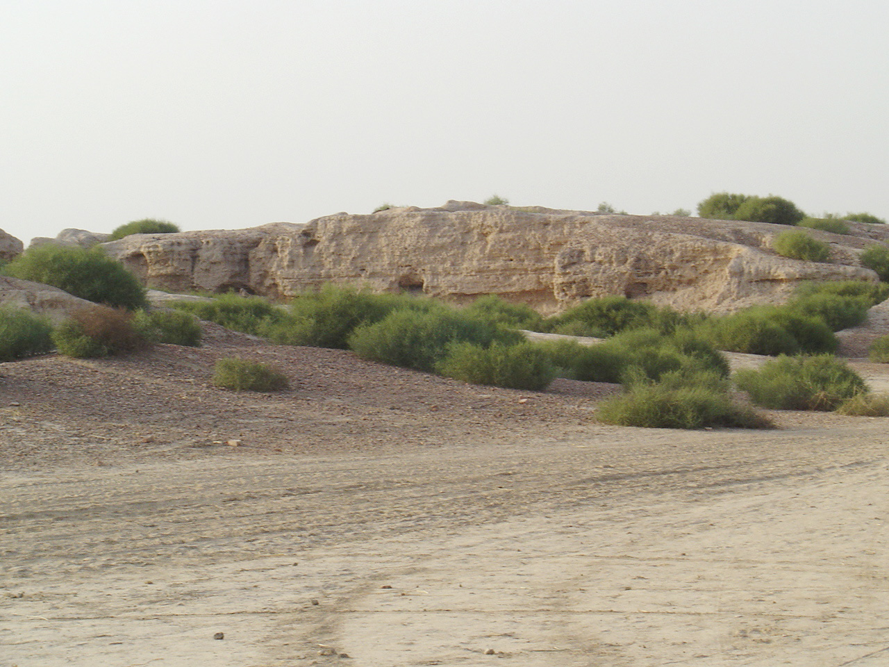
Photo: Kk himalaya · Public domain · Wikimedia Commons
Kalibangan is a town on the banks of the Ghaggar River in India. Kalibangan means black bangles in the local language. The free Lokali audio guide runs 7 minutes.
✓ Published October 2026 · how we write these guides
Visitor facts
| Lokali audio guide | 7 min · free |
|---|---|
| Type | Archaeological Site |
| Location | Hanumangarh district, India |
| Coordinates | 29.4739, 74.1297 |
| Languages | 50+, in the Lokali app |
The story
Listen to the wind for a moment. It moves across these low brown mounds and lifts a fine dust. Underfoot the ground is soft, pale, and scattered with small broken pieces of fired clay. Some fragments are red. Some are black. Out here in the far north of Rajasthan the horizon is very wide, and the sky feels close. You are standing on one of the oldest planned towns in South Asia. Almost nothing of it rises above your knees.
The name Kalibangan comes from the local language. It means, quite simply, black bangles. For generations, villagers walking these mounds picked up dark fragments of bangles from the surface. Nobody here knew how old they were. Those small pieces of clay gave the place its name long before any archaeologist arrived. So the first surprise is this: the people living nearby named the site after its ancient jewellery, without knowing they were doing it.
The outside world learned about Kalibangan in the early twentieth century. An Italian scholar named Luigi Pio Tessitori travelled through this region studying its languages and old texts. He noticed these mounds and recorded them. He suspected they were very old, but he could not know how old. Decades later, after the partition of India in 1947, Indian archaeologists began searching hard for sites of the Indus civilisation on their side of the new border. This place became one of their most important discoveries.
In the 1960s the Archaeological Survey of India excavated here for several seasons. The work was led by two archaeologists, B. B. Lal and B. K. Thapar. They found that Kalibangan belonged to the Harappan world — the great Bronze Age civilisation of the Indus and its neighbouring rivers. That civilisation built cities with straight streets, drains, and standard bricks, at roughly the same time as early Egypt and Mesopotamia. Kalibangan showed that its reach extended deep into what is now Rajasthan.
Look at the shape of the land around you. There are two main mounds. The smaller one, to the west, is usually called the citadel. The larger one, to the east, is the lower town, where most ordinary people lived. Both were once surrounded by thick walls of mud brick. Further east lies a third, much smaller mound. Each of these areas seems to have had its own role in the life of the town.
The excavators found two main phases of life here. The first came before the full Harappan period, and archaeologists call it the Early Harappan phase. The second was the mature Harappan town. One quiet clue separates them: the size of the bricks. In the earlier phase, the bricks follow one set of proportions. In the later phase, they follow the standard Harappan proportion of four to two to one. Even mud bricks carry the signature of a wider culture.
Now for the discovery that made Kalibangan famous among archaeologists. Outside the walls of the early settlement, the excavators found an ancient field. Its surface still showed furrows from a plough. The lines ran in two directions, crossing each other in a grid. It is often described as one of the earliest ploughed fields ever found anywhere in the world. Think about that. Under this dust, someone preserved the marks of a farmer's work from nearly five thousand years ago.
The pattern of those furrows holds a second surprise. Farmers in this region still plough some fields in the same crossing pattern today. They use it to grow two crops together in one field, with wide and narrow spacing in different directions. Some scholars suggest the ancient farmers did the same. That idea is an interpretation, not a proven fact. Still, it is striking to imagine a farming habit lasting across so many centuries, on the same soil.
Kalibangan also gave us a puzzle about belief. On the citadel and on the small eastern mound, archaeologists found rows of small clay-lined pits. They contained ash, charcoal, and sometimes animal bones. Many scholars describe them as fire altars, used for some kind of ritual. Exactly what those rituals were remains uncertain. We have no written explanation, because nobody has yet deciphered the Harappan script. The altars show us a practice clearly, but they keep its meaning to themselves.
That script appears here too. The excavations produced seals and pottery marked with Harappan signs. The excavators also found evidence of a cemetery to the southwest of the citadel, with burials of different kinds. Some researchers have also pointed to cracks and displaced layers in the early town and linked them to an ancient earthquake. If that reading is correct, it would be one of the oldest earthquakes recorded through archaeology. It is a fascinating idea, but specialists still discuss the details.
Now turn toward the river. The town stands beside the Ghaggar, a seasonal river that is often dry for much of the year. In ancient times it carried far more water. Many scholars believe that changes in this river helped bring the end of Kalibangan, as the water that fed the fields became less reliable. Some people identify the Ghaggar with the Sarasvati, a sacred river in early Indian texts. That identification is widely discussed, and it is not settled.
Near the site, a small museum displays objects from the excavations. Inside you can see pottery, bangles, beads, seals, and tools, and photographs of the original digs. It helps to visit it before or after walking the mounds. On the ground, the remains are subtle — low walls, outlines, and dust. In the museum, the objects give those outlines a human face. You can see the bangles that gave this place its name, close enough to study their colour and shape.
Before you leave, stand still once more. Look at the low line of the citadel, and the open fields beyond it, where farmers still plough the same land. Notice the fragments of clay at your feet, and leave them where they lie. They belong to the site. As you walk back, listen to the wind again. It is the same wind that crossed these streets, these walls, and that ancient field, long before anyone came to read their story.
Key facts
What to look for
Practical tips
Common questions
Is there a free audio guide to Kalibangan?
Yes — the Lokali app narrates Kalibangan free of charge in 50+ languages. The guide runs about 7 minutes, covers the history, what to look for on site and practical tips, and works offline once downloaded.
Where is Kalibangan?
Kalibangan is near Hanumangarh district, India, at 29.4739, 74.1297. Tap the map link on this page for directions from where you are.
What is Kalibangan known for?
Kalibangan means black bangles in the local language. Luigi Pio Tessitori recorded the mounds in the early twentieth century.
What should you look for at Kalibangan?
Two separate mounds marking the citadel and lower town. Low mud-brick wall outlines traced across the citadel. Red and black clay fragments scattered on the surface.
What should you know before visiting Kalibangan?
Visit the site museum to see objects behind the ruins. Bring water and sun protection for the open mounds.
When is the best time to visit Kalibangan?
Come early morning to avoid the strongest desert heat.
On the map
Opens directions to Kalibangan from your location.
Hear Kalibangan in your language
The full story, narrated, in 50+ languages. Download it before you go and it plays offline, at your own pace, with no ticket and no tour group.