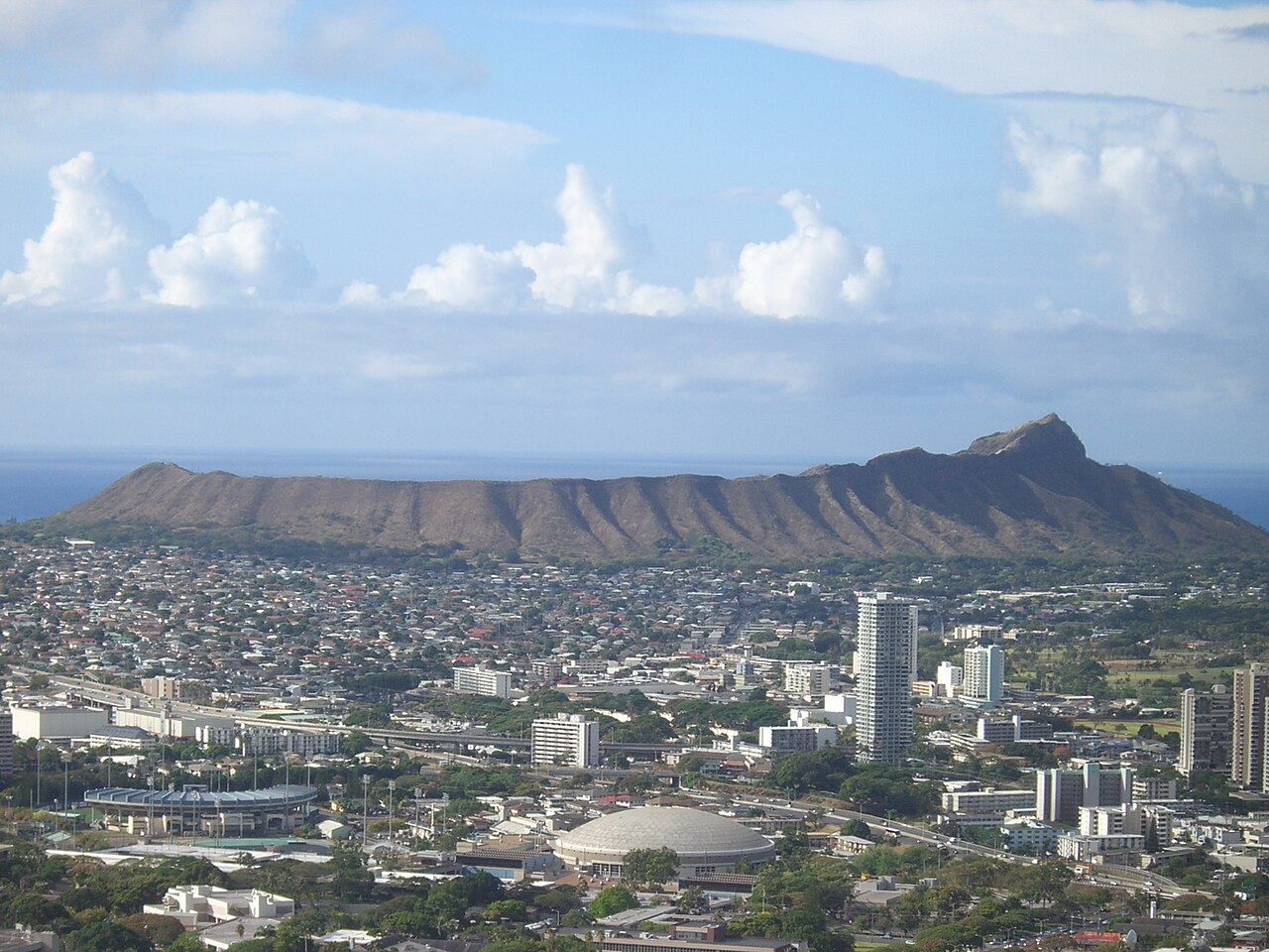
Diamond Head is a 760-foot tuff cone rising from Waikiki Beach, formed roughly 300,000 years ago. It is in Honolulu, United States. Most visitors spend 1–2 hours here. The free Lokali audio guide runs 5 minutes.
✓ Verified August 2026 · how we write these guides
Visitor facts
| Time needed | 1–2 hours |
|---|---|
| Lokali audio guide | 5 min · free |
| Type | Volcanic Peak |
| Best for | Photography |
| Location | Honolulu, United States |
| Coordinates | 21.2557, -157.8095 |
| Languages | 45, in the Lokali app |
The story
The wind reaches you first at the rim. It carries salt and the smell of the sea far below. Around you the land falls away into a wide bowl of dry golden grass and bare stone. The slopes are steep, and the sky feels very close. This is Diamond Head, the great crater that watches over the south shore of Oahu.
Hawaiians named this place Leahi long before any ship arrived. The name points to the shape of the ridge, which curves like the brow of a tuna fish. The crater itself is the worn rim of an old volcano. It formed hundreds of thousands of years ago, in a single short and violent burst from the floor of the sea.
This eruption did not flow slowly like the other Hawaiian volcanoes. Instead, rising magma met water, and ash and steam exploded high into the sky. The ash settled and slowly hardened into a wide ring of rock. That ring is what you stand on now. The crater is broad and shallow, open to the sun, and strangely quiet.
The English name came much later. In the nineteenth century, British sailors saw small crystals shining in the rock along the slopes. They believed they had found diamonds, and grew excited at the thought. The crystals were only calcite, common and worth nothing at all. The sailors left disappointed, but the name Diamond Head has remained ever since.
For the Hawaiian people, this was a sacred place. On the slopes once stood a temple, a heiau, built of stacked stone. Chiefs are said to have offered prayers here to their gods. The high ground gave them a long and open view out to sea. From here they could watch for approaching canoes and for any change in the weather.
Much later the crater became a fortress. In the early twentieth century, the Honolulu Army took control of the land. They named the post Fort Ruger. They understood that whoever held this height could guard the harbor and the whole southern coast. So they began to dig into the ancient rock of the crater wall.
Soldiers cut tunnels straight through the crater wall. They built bunkers and lookout posts along the high rim. They set heavy guns in place to defend the island from attack by sea. The steep summit trail that you climb today was first built in 1908 to reach these military posts high above the floor.
The path is narrow and steep in places. It rises from the crater floor toward the highest point on the rim. Along the way you pass switchbacks of dusty stone, then a dark tunnel cut straight through the solid rock. After the tunnel comes a long and tiring climb of stairs. Carry water with you, because there is very little shade.
Near the top stands an old concrete observation station. From inside it, soldiers once watched the open sea and directed the guns far below. You climb the last narrow steps and pass through its cool, dim rooms. Then you step out into the light, and the view opens all at once, wide and bright before you.
At the summit you stand about 760 feet above the sea. Below you spreads the long coast of Honolulu. You can see the curve of beach at Waikiki, the close rows of white hotels, and the deep blue water beyond them. On a clear day the view runs for many miles in both directions along the shore.
Now turn and look down into the crater behind you. It is dry and quiet, a different world from the green hills nearby. The high walls block much of the passing rain, so little grows on the floor below. The silence up here is broken only by the steady wind and the voices of other climbers around you.
Take a moment at the railing before you start back down. People of many languages stand around you, all of them a little out of breath, all of them looking out at the same wide sea. The climb is short, but the reward is large. Few places on the whole island give back so much for a single hour of effort.
Diamond Head has been many things across its long life. A volcano, a sacred height, a place of war, and now a place where travelers come simply to climb. The rock itself does not change. The people who stand upon it do. Take one slow breath at the rim, feel the wind, and look out at the ocean that made these islands.
Key facts
What to look for
Practical tips
Common questions
How long do you need at Diamond Head?
Plan 1–2 hours. That is the time most visitors spend at Diamond Head. The free Lokali audio guide adds about 5 minutes of narration you can listen to as you walk, so it fits inside your visit rather than adding to it.
Is there a free audio guide to Diamond Head?
Yes — the Lokali app narrates Diamond Head free of charge in 50+ languages. It covers the history, what to look for on site and practical tips, and it works offline once downloaded.
Where is Diamond Head?
Diamond Head is in Honolulu, United States, at 21.2557, -157.8095 Tap the map link on this page for directions from where you are.
What should you know before visiting Diamond Head?
Arrive early to avoid the heat and crowds.
What is Diamond Head known for?
Hawaiian name Leahi means brow of the tuna.
What is the best time to visit Diamond Head?
Hike in early morning to avoid heat and crowds.
On the map
Opens directions to Diamond Head from your location.
More to see in Honolulu

Hear Diamond Head in your language
The full story, narrated, in 50+ languages. Download it before you go and it plays offline, at your own pace, with no ticket and no tour group.