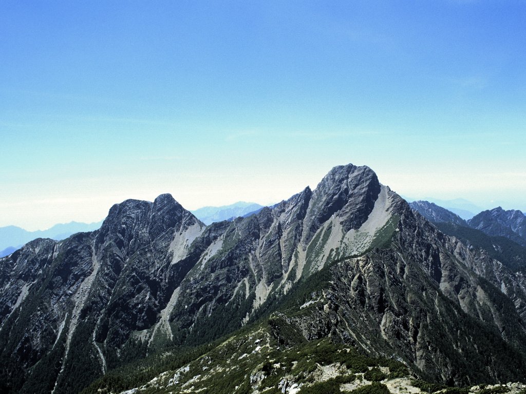
Yushan National Park
23.4700° N · 120.9573° E · National Park
Photo: original-uploaded by Kailing3 · CC BY-SA 3.0 · Wikimedia Commons
Yushan National Park is a national park in Taiwan. Yushan National Park was established in 1985. The free Lokali audio guide runs 6 minutes.
✓ Published October 2026 · how we write these guides
Visitor facts
| Lokali audio guide | 6 min · free |
|---|---|
| Type | National Park |
| Location | Hualien County, Taiwan |
| Coordinates | 23.4700, 120.9573 |
| Official website | ysnp.gov.tw |
| Languages | 50+, in the Lokali app |
The story
Listen first. Water moves somewhere below you, out of sight, over stones. The air smells of wet earth and moss. A bird calls once from the canopy and goes quiet. On the Hualien side of Yushan National Park, the mountains do not arrive all at once. They come to you slowly, valley by valley, wrapped in cloud.
You are standing at the eastern edge of a very large protected landscape. Yushan National Park was established in 1985. It stretches across the high spine of central Taiwan and touches four counties, with Hualien on its eastern flank. The park takes its name from Yushan, which means Jade Mountain in Mandarin. At 3,952 metres, Yushan is the highest peak in Taiwan and one of the highest island mountains on Earth.
Here is the first surprise. Most visitors picture Yushan as a single summit climbed from the western side. But the park is much bigger than one mountain. It holds dozens of peaks above three thousand metres. And on this eastern side, in Zhuoxi Township, the experience is different. It is quieter, greener, and more about the forest and the river than the summit itself.
The main gateway on this side is the Walami Trail. It begins near the Nanan area, where the park has a visitor centre. From the first steps, you walk into a lowland forest of ferns, broadleaf trees, and hanging vines. The path is narrow and often damp. Moss covers the rock walls beside you. In places, small streams cross the trail, so you will hear water almost the whole way.
This trail has a layered past. The Walami Trail follows part of the Batongguan Traverse Road, a mountain route built during the Japanese colonial period in the early twentieth century. Japan ruled Taiwan from 1895 to 1945. The route was designed to cross the island's central mountains and to control access to Indigenous communities living in the highlands. Along the way, the Japanese built police stations. Today, only traces of some of them remain in the forest.
That history matters, because these mountains were never empty. They are the traditional home of the Bunun people, one of Taiwan's Indigenous nations. The Bunun lived, hunted, and farmed across these high valleys for generations. They are known for a remarkable form of choral song. It is a slow harmony sung by a group of men to pray for a good millet harvest. Visitors who hear it often describe it as sounding like the mountain itself is breathing.
As you walk on, watch for the suspension bridges. The trail crosses several deep gullies on narrow steel bridges strung with cables. They sway a little under your feet. Below, the water is clear and very cold, running over pale grey stones. Pause in the middle of one. Look up the valley, and you will often see layers of ridgelines fading into mist, each one a lighter shade of blue-green.
Not far from the trailhead, many day walkers reach Shanfeng Waterfall. It is a good place to stop. The water falls in a white ribbon down a dark rock face and gathers in a pool below. In the wet months, after heavy rain, the sound becomes a steady roar. In drier weeks, it softens. Either way, the spray cools the air around you, and the rocks nearby stay slick and green.
Now for the second surprise. Within a single national park, you can pass through several climate zones. Down here, the forest feels subtropical, warm and humid. Climb higher, and the trees change to cooler mixed forest, then to conifers. Near the highest peaks, the landscape becomes alpine, with low shrubs, bare rock, and winter snow. Few places on Earth pack so many zones into such a short horizontal distance.
That range of habitats supports a lot of wildlife. The Formosan black bear, with its pale V-shaped mark on the chest, lives in these mountains, though you are very unlikely to see one. Formosan rock macaques are more common, and you may hear them crashing through the branches. Keep an eye out for pheasants on the forest floor. The Mikado pheasant and Swinhoe's pheasant are both found only in Taiwan.
During the Japanese period, Yushan had another name. It was called Niitakayama, meaning New High Mountain. The name came from a simple fact. This peak stood higher than Mount Fuji, which until then had been the highest mountain in the Japanese empire. So, for a few decades, the tallest point in that empire stood here, in the centre of Taiwan.
A practical word, gently. The deeper sections of the Walami Trail, and the overnight routes beyond, need permits arranged in advance. Weather here changes quickly. A clear morning can turn to cloud and rain by early afternoon. Landslides sometimes close parts of the trail, especially after typhoons. Before you set out, check the latest conditions with park staff, and be ready to turn back early. The mountain will still be here next time.
Before you leave, stand still for one more moment. Notice the colour of the river below, the moss on the nearest stone, the way the cloud moves along the ridge. Somewhere far above, beyond all those folds of green, the summit of Jade Mountain stands in its own weather. You may never see it from here. But as you walk back toward the road, you are walking out of its shadow, one quiet step at a time.
Key facts
What to look for
Practical tips
Common questions
Is there a free audio guide to Yushan National Park?
Yes — the Lokali app narrates Yushan National Park free of charge in 50+ languages. The guide runs about 6 minutes, covers the history, what to look for on site and practical tips, and works offline once downloaded.
Where is Yushan National Park?
Yushan National Park is near Hualien County, Taiwan, at 23.4700, 120.9573. Tap the map link on this page for directions from where you are.
What is Yushan National Park known for?
Yushan National Park was established in 1985. Yushan summit stands 3,952 metres, Taiwan's highest peak.
What should you look for at Yushan National Park?
Swaying steel suspension bridges over deep river gullies. Shanfeng Waterfall's white ribbon on dark rock. Thick moss and ferns lining the trail walls.
What should you know before visiting Yushan National Park?
Start early; afternoon cloud and rain often roll in. Arrange permits ahead for deeper or overnight trail sections.
When is the best time to visit Yushan National Park?
Pack rain gear even when the morning looks clear.
On the map
Opens directions to Yushan National Park from your location.
More to see near Yushan National Park

Hear Yushan National Park in your language
The full story, narrated, in 50+ languages. Download it before you go and it plays offline, at your own pace, with no ticket and no tour group.