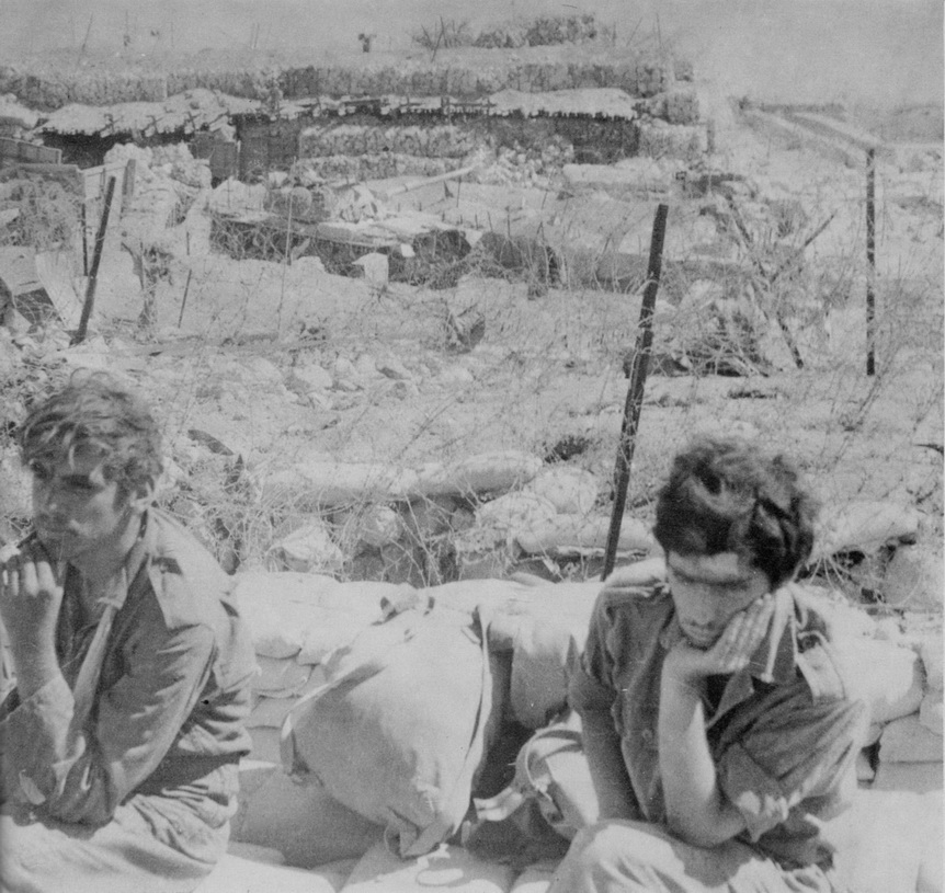
Photo: Wikimedia Commons contributor · Public domain · Wikimedia Commons
Bar Lev Line is a chain of fortifications built by Israel. It is near Ismailia, Egypt. Built by Israel after capturing Sinai in 1967. The free Lokali audio guide runs 7 minutes.
✓ Published October 2026 · how we write these guides
Visitor facts
| Lokali audio guide | 7 min · free |
|---|---|
| Type | Fortification |
| Location | Ismailia, Egypt |
| Coordinates | 30.5250, 32.3350 |
| Languages | 50+, in the Lokali app |
The story
Stand still for a moment and feel the ground. It is not rock here, and it is not soil. It is sand, fine and pale, and it shifts slightly under your weight. Across the water, the canal is flat and green-grey. A ship may slide past, so tall and so close that it looks like a building moving through the desert. The wind carries salt and dust. This quiet bank was once one of the most heavily fortified places in the Middle East.
You are on the edge of the Suez Canal, near the city of Ismailia. The canal links the Mediterranean Sea to the Red Sea, and it divides Africa from Asia. On the western side lies mainland Egypt. On the eastern side lies the Sinai Peninsula. For six years, from 1967 to 1973, this narrow strip of water was a front line. The remains of the Bar Lev Line sit along the eastern bank.
The story begins with the war of June 1967, often called the Six-Day War. In that war, Israel captured the Sinai Peninsula from Egypt. Israeli forces now faced Egyptian forces directly across the canal. Neither side accepted the situation. Soon the two armies were firing artillery at each other across the water. This long, grinding conflict became known as the War of Attrition. It lasted until a ceasefire in 1970.
To protect its soldiers on the eastern bank, Israel built a chain of defences. The line took its name from Haim Bar-Lev, who was the Israeli army's Chief of Staff at the time. It was not a single wall. It was a system. There was a long, steep embankment of sand along the water's edge. Behind it, and built into it, there were fortified strongpoints. Israelis called these strongpoints by a Hebrew word that means fortresses.
The sand rampart was the most important part. Engineers piled it high and steep, often cited at around twenty metres in places. That is roughly the height of a six-storey building. The slope was angled so that vehicles could not climb it. Any army crossing the canal would land on a narrow shore and face a wall of loose sand. Tanks would sink. Soldiers would struggle. Planners believed that the barrier could hold back an attack for a long time.
The strongpoints were small, tough positions. They had bunkers, trenches, firing positions and shelters reinforced against shelling. Soldiers lived inside them for weeks at a time, in heat and dust. Behind the line, there were roads, artillery positions and armoured units ready to respond. The whole system relied on time — the hope that defenders could hold long enough for reinforcements to arrive.
Now comes the surprise that most visitors do not expect. The answer to this great wall of sand was water. Egyptian military engineers studied the rampart for years. One engineer, Baki Zaki Youssef, is widely credited with a simple idea. He had worked on the Aswan High Dam, where high-pressure water was used to move earth. Why not use the same method here? The canal itself would provide the water.
Egypt acquired powerful water pumps and trained its engineers in secret. The plan was to spray jets of water at the sand until it collapsed, opening gaps for bridges and vehicles. Explosives might take many hours to cut a path. Water could do it faster. It is one of the strange ironies of military history. The canal was the obstacle, and the canal also became the tool that broke the barrier.
The attack came on the sixth of October, 1973. It was the holy day of Yom Kippur in Israel, and it fell during the month of Ramadan in Egypt. In the early afternoon, Egyptian artillery opened fire along the canal. Thousands of soldiers crossed in small rubber boats. They climbed the rampart with rope ladders. Behind them, engineers turned their water cannons on the sand. Within hours, gaps opened, and pontoon bridges began to stretch across the water.
This was the opening of the October War, as Egyptians call it, or the Yom Kippur War, as it is known in Israel. Many strongpoints fell in the first days, while others held out for a time. The fighting that followed was hard and costly for both sides, and the war ended with a ceasefire later that month. In the years after, diplomacy changed the map. Egypt and Israel signed a peace treaty in 1979, and Sinai returned to Egypt.
For Egyptians, the crossing remains a moment of deep national pride. The sixth of October is a national holiday, celebrated as Armed Forces Day. A new city near Cairo carries the name Sixth of October City. Ismailia itself has a long connection to the canal. It grew in the nineteenth century as a base for the canal's construction. Its name honours Khedive Ismail, the ruler of Egypt in that period.
Today, parts of the old line survive on the eastern bank. Some strongpoints have been preserved as memorial sites, with bunkers and trenches you can walk through. Others have faded back into the desert, leaving only low mounds and broken concrete. The rampart itself is lower and softer now in many places. Wind and time have done slowly what the water cannons did in an afternoon. Access to some sites may need to be arranged in advance.
If you walk into a bunker, notice how small it feels. Notice the thick walls, the narrow openings, the heat that gathers inside. Then step out and look west across the canal. You can see how close the other bank is. The soldiers on each side could watch each other every day. That short distance across the water held years of tension, and then a few days of intense battle.
Before you leave, look at the sand under your feet once more. It looks harmless. It moves with the wind. Watch the next ship pass slowly between the two continents, carrying its cargo from one sea to another. The canal carries trade again, as it was built to do. And the fortress that once guarded this shore is now mostly sand, quiet in the light.
Key facts
What to look for
Practical tips
Common questions
Is there a free audio guide to Bar Lev Line?
Yes — the Lokali app narrates Bar Lev Line free of charge in 50+ languages. The guide runs about 7 minutes, covers the history, what to look for on site and practical tips, and works offline once downloaded.
Where is Bar Lev Line?
Bar Lev Line is near Ismailia, Egypt, at 30.5250, 32.3350. Tap the map link on this page for directions from where you are.
What is Bar Lev Line known for?
Built by Israel after capturing Sinai in 1967. Named after Israeli Chief of Staff Haim Bar-Lev.
What should you look for at Bar Lev Line?
Thick concrete walls inside the preserved bunkers. Narrow firing openings facing the canal. Low remains of the old sand rampart.
What should you know before visiting Bar Lev Line?
Arrange site access in advance through a local tour operator. Bring water and a hat for exposed desert heat.
When is the best time to visit Bar Lev Line?
Visit in the morning before the sand gets hot.
On the map
Opens directions to Bar Lev Line from your location.
More to see in Ismailia


Hear Bar Lev Line in your language
The full story, narrated, in 50+ languages. Download it before you go and it plays offline, at your own pace, with no ticket and no tour group.