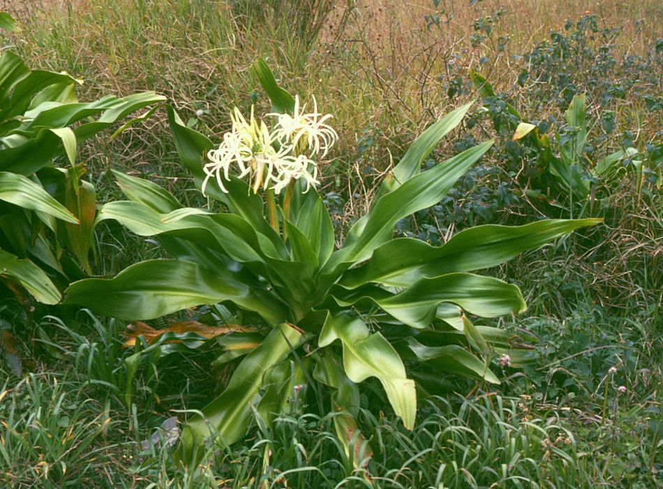
Preah Monivong National Park
10.8620° N · 104.0322° E · National Park
Photo: Franz Xaver · CC BY-SA 3.0 · Wikimedia Commons
Preah Monivong National Park is a national park in Cambodia. Park is named after King Sisowath Monivong. The free Lokali audio guide runs 7 minutes.
✓ Published October 2026 · how we write these guides
Visitor facts
| Lokali audio guide | 7 min · free |
|---|---|
| Type | National Park |
| Location | Kampot, Cambodia |
| Coordinates | 10.8620, 104.0322 |
| Languages | 50+, in the Lokali app |
The story
The air changes first. As the road climbs above Kampot, the heavy coastal heat thins out. Cool, damp wind comes through the window, carrying the smell of wet leaves and moss. Then, quite often, the cloud arrives. It rolls across the road in soft grey sheets, and the world below disappears. This is Preah Monivong National Park, which most people here simply call Bokor. Welcome to the mountain.
The park takes its formal name from King Sisowath Monivong, who ruled Cambodia in the early twentieth century, under French protection. Bokor is the name of the plateau itself, and the name you will hear from drivers, guesthouse owners, and almost everyone in town. The plateau rises roughly a thousand metres above the sea. On a clear day, the land drops away to the Gulf of Thailand, with islands scattered across the water. On a cloudy day, you stand inside the weather.
That cool climate is the reason the plateau was developed at all. In the 1920s, French colonial administrators wanted an escape from the lowland heat. They built a hill station up here — a small mountain retreat with a grand hotel, villas, a post office, and a church. For a few decades, officials and wealthy visitors came up to breathe the cool air, dine, and gamble. It was a little piece of provincial France, set on a Cambodian mountaintop.
The cost of that retreat was paid by others. The road and buildings were cut and carried by forced and poorly paid labour, through dense jungle and steep terrain. Local accounts say that many workers died during construction, from disease, accidents, and exhaustion. The exact number is uncertain, and different sources give different figures. But this is worth holding in mind as you walk among the old buildings. The elegance up here was built on hard human suffering.
The hill station's good years did not last long. After the Second World War, Cambodia's struggle for independence reached the mountain, and the French residents left. Later, under King Norodom Sihanouk, the plateau had a second life as a retreat. But in the 1970s, war came again. The Khmer Rouge held positions here, and the plateau became a military zone. Fighting continued on and off for years, and the old buildings were left empty, scarred, and open to the rain.
That history explains the strange beauty of the old Bokor Palace Hotel. For decades, it stood as a hollow shell, its walls stained orange and black with lichen and mould. Visitors walked through empty ballrooms with the cloud drifting in through the windows. The building became a ghostly landmark, and it even appeared in films. In recent years, the hotel was restored and reopened. Some visitors miss the old ruin. Others are simply glad to see it standing whole again.
A short distance away, the old Catholic church sits alone on the open ground. It is a small, simple building, with a square tower and plain stone walls. Up close, you can see the patches of lichen and the marks of weather. Inside, the space is quiet and bare. When cloud moves past the doorway, the light inside turns soft and pale. Many visitors find this the most moving place on the whole plateau.
Now, here is something many people miss. Bokor is not only a story of buildings. It is a protected forest, and one of the larger natural areas in southern Cambodia. The slopes hold evergreen forest, and the plateau top has a different, more open landscape of low shrubs, mosses, and wind-shaped plants. Birdwatchers come for hornbills and other forest birds. Larger animals live in the deeper forest too, though they rarely show themselves near the road.
One of the most visible landmarks is not old at all. On a high point stands a large statue of Lok Yeay Mao, a guardian spirit honoured along this coast. She is often described as a protector of travellers, hunters, and fishermen. Locals say that people pass her shrine with respect, and many stop to leave offerings of incense, fruit, or flowers. Watch how Cambodian visitors behave here. Their quiet gestures tell you this is a living place of faith.
Nearby is Wat Sampov Pram, a Buddhist temple whose name means the Temple of Five Boats. The name comes from a group of large rocks on the hillside. According to a local legend, these rocks are the remains of boats turned to stone. Whatever you believe, the setting is calm. Monks in saffron robes move between the buildings, and the temple terrace looks down toward the coast — when the cloud allows it.
Water is the other great feature of the plateau. Popokvil Falls runs over rock shelves in two tiers, fed by the heavy rains that soak this mountain. The flow depends completely on the season. During the wet months, the water is loud and white. In the dry season, it can shrink to a thin trickle across bare stone. Either way, the rocks near the water are slippery, so take care where you put your feet.
It is also worth knowing that Bokor is changing quickly. In recent years, a large resort development has risen on the plateau, with a casino, hotels, and new roads. Some visitors find the contrast jarring — modern towers beside old ruins and wild forest. Others see it as the latest chapter in a long cycle. The French built here for pleasure, war emptied it, and now developers have returned. The mountain has been reinvented many times.
So take a moment, wherever you are standing now. Feel the cool air on your skin, so different from the coast below. Listen for the wind across the plateau, or the drip of water from the trees. If the cloud is in, enjoy the quiet grey world it makes. If it lifts, look down at the sea and the islands. Then, as you head back toward Kampot, notice the moment the warm air returns — and the mountain disappears behind you.
Key facts
What to look for
Practical tips
Common questions
Is there a free audio guide to Preah Monivong National Park?
Yes — the Lokali app narrates Preah Monivong National Park free of charge in 50+ languages. The guide runs about 7 minutes, covers the history, what to look for on site and practical tips, and works offline once downloaded.
Where is Preah Monivong National Park?
Preah Monivong National Park is near Kampot, Cambodia, at 10.8620, 104.0322. Tap the map link on this page for directions from where you are.
What is Preah Monivong National Park known for?
Park is named after King Sisowath Monivong. French built the Bokor hill station in the 1920s.
What should you look for at Preah Monivong National Park?
Orange and black lichen on the old church walls. Rock formations said to be five boats at Wat Sampov Pram. Incense and offerings at the Lok Yeay Mao statue.
What should you know before visiting Preah Monivong National Park?
Bring a light jacket for cool, damp mountain air. Check the cloud cover before driving up for views.
When is the best time to visit Preah Monivong National Park?
Visit Popokvil Falls in rainy season for stronger flow.
On the map
Opens directions to Preah Monivong National Park from your location.
Hear Preah Monivong National Park in your language
The full story, narrated, in 50+ languages. Download it before you go and it plays offline, at your own pace, with no ticket and no tour group.