Mosi-oa-Tunya National Park
17.8667° S · 25.8333° E · National Park
Photo: Hans Hillewaert · CC BY-SA 4.0 · Wikimedia Commons
Mosi-oa-Tunya National Park is a national park of Zambia. Mosi-oa-Tunya means "the smoke that thunders" in Kololo. The free Lokali audio guide runs 7 minutes.
✓ Published October 2026 · how we write these guides
Visitor facts
| Lokali audio guide | 7 min · free |
|---|---|
| Type | National Park |
| Location | Livingstone, Zimbabwe |
| Coordinates | -17.8667, 25.8333 |
| Languages | 50+, in the Lokali app |
The story
Before you see anything, you feel it. A fine, cool mist settles on your arms and your face. The ground under your feet is damp, even on a dry afternoon. And beneath every other sound, there is a low, steady roar — like distant traffic that never stops. That roar is the Zambezi River, falling off the edge of a cliff just ahead of you.
Welcome to Mosi-oa-Tunya National Park, on the Zambian side of the Victoria Falls. The name comes from the local Kololo language, and it is usually translated as "the smoke that thunders." Stand here for a minute and the name makes sense. The smoke is the column of spray that rises above the gorge. The thunder is the water itself. People gave this place that name long before any European map showed it.
The park itself is small, but it has two very different halves. One half protects the falls, the gorge, and the strip of rainforest along the cliff edge. The other half lies upstream, along the quiet banks of the Zambezi. That upstream section is a game park, with antelope, zebra, giraffe, buffalo, and elephants that move through the riverine woodland. Most visitors only see the waterfall. Far fewer realise that wildlife lives just a short drive away.
Together with Victoria Falls National Park across the river in Zimbabwe, this park forms a single UNESCO World Heritage Site. It was listed in 1989. The border between the two countries runs down the middle of the Zambezi. So when you look across the gorge at the far cliff, you are looking at another nation. The water, of course, ignores the border completely.
Now look at the shape of the falls. The Zambezi here is very wide — well over a kilometre and a half from bank to bank. The whole river drops more than a hundred metres into a narrow crack in the earth. That crack is cut into dark basalt, a hard volcanic rock. Over a very long time, the water has worn away weaker lines in the basalt. Each time it breaks through, the falls move back and a new gorge forms. Downstream, you can see this history as a series of zigzag gorges, one after another.
Here is something most visitors miss. The narrow strip of green along the cliff edge is a true rainforest. It does not exist because of rainfall. It exists because of the spray. The mist from the falls waters these trees day and night, so plants grow here that you will not find in the dry bush a few hundred metres away. Walk the paths and notice how suddenly the air changes — from dusty savanna to wet, dripping green.
The Scottish missionary and explorer David Livingstone reached the falls in 1855. He is generally recorded as the first European to see them. He named them after Queen Victoria, and the nearby town of Livingstone later took his own name. But the local Tonga, Kololo, and Lozi peoples knew this place long before he arrived. For them, the falls and the river carried spiritual meaning, and in some traditions the spray was a place connected with ancestors.
Locals also tell stories of Nyami Nyami, the river god of the Tonga people. According to popular tales, he is a great serpent-like spirit who lives in the Zambezi and guards its waters. You will see his curving shape carved into wooden walking sticks and pendants in the craft markets near the park. Whether you treat it as faith or folklore, the legend shows how closely people here have lived with this river.
One of the most memorable walks on this side is across the Knife-Edge Bridge. It is a narrow footbridge that crosses a gap in the rocks, right in the path of the spray. In the high-water months, roughly from the end of the rainy season into the middle of the year, you will be soaked in seconds. Visibility can drop to almost nothing. In the dry months, like now in the second half of the year, the Zambian side can thin out to separate streams, and the bare rock face becomes visible.
That dry season brings its own surprise. When the water is low, small groups visit Livingstone Island, at the very lip of the falls. From there, guided swimmers enter a natural rock pool at the edge, often called Devil's Pool. A ridge of rock holds the water back from the drop. It sounds impossible, and it requires an official guide, but it shows how much this place changes from season to season.
If you follow the path down toward the gorge, you reach a viewpoint over a churning bend in the river called the Boiling Pot. Here the water swirls in deep circles after leaving the main falls. Above it, you will see the Victoria Falls Bridge, a steel arch that spans the gorge between Zambia and Zimbabwe. It was completed in the early twentieth century, as part of a colonial dream of a railway across Africa. Trains, cars, and pedestrians still cross it today.
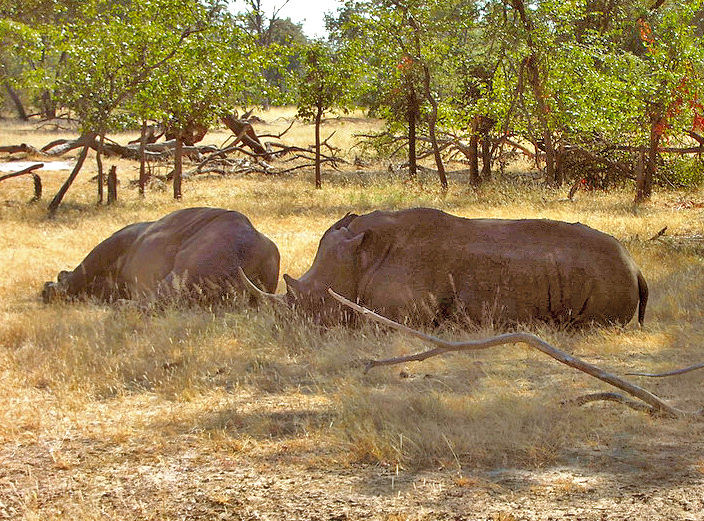
The upstream game park has a quieter story. White rhinos were reintroduced here, and they are protected by armed wildlife scouts who follow them closely. Seeing one usually means joining a guided walk with those scouts. It is a reminder that this park is not only scenery. It is also a working conservation area, protecting animals that were once lost from this part of Zambia. Inside the park you can also find an old settlers' cemetery, a sober trace of the early colonial years, when fever took many lives.
Before you leave, stop once more and simply listen. The roar does not change, but your attention will. You may hear birds in the wet trees, the drip of water from the leaves, the chatter of baboons nearby. Look up at the spray rising into the sky. On a clear day, it can be seen from far across the land. As you walk away, keep turning back. That white column will stay in view long after the falls themselves are hidden.
Key facts
What to look for
Practical tips
Common questions
Is there a free audio guide to Mosi-oa-Tunya National Park?
Yes — the Lokali app narrates Mosi-oa-Tunya National Park free of charge in 50+ languages. The guide runs about 7 minutes, covers the history, what to look for on site and practical tips, and works offline once downloaded.
Where is Mosi-oa-Tunya National Park?
Mosi-oa-Tunya National Park is near Livingstone, Zimbabwe, at -17.8667, 25.8333. Tap the map link on this page for directions from where you are.
What is Mosi-oa-Tunya National Park known for?
Mosi-oa-Tunya means "the smoke that thunders" in Kololo. Joint UNESCO World Heritage Site with Zimbabwe since 1989.
What should you look for at Mosi-oa-Tunya National Park?
The dripping rainforest strip fed only by spray. Dark basalt rock along the bare gorge walls. Zigzag gorges stretching downstream from the falls.
What should you know before visiting Mosi-oa-Tunya National Park?
Bring a waterproof bag for phones in high-water months. Rent or bring a raincoat before crossing the Knife-Edge Bridge.
On the map
Opens directions to Mosi-oa-Tunya National Park from your location.
More to see near Mosi-oa-Tunya National Park

Hear Mosi-oa-Tunya National Park in your language
The full story, narrated, in 50+ languages. Download it before you go and it plays offline, at your own pace, with no ticket and no tour group.