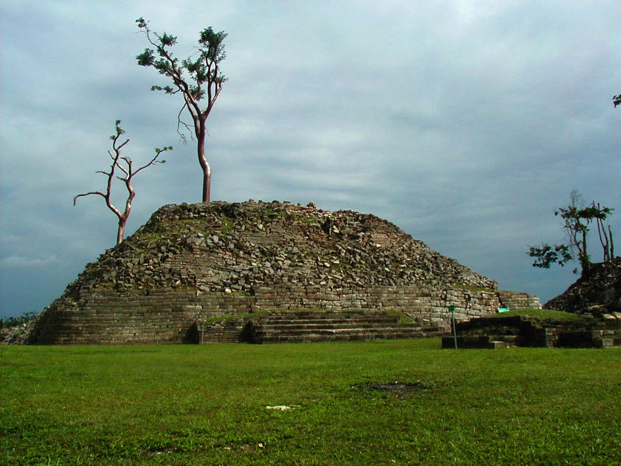
Photo: Wikimedia Commons contributor · CC BY-SA 2.0 · Wikimedia Commons
Lubaantun is an archaeological site. It is near Toledo, Belize. Name means place of fallen stones in Yucatec Maya. The free Lokali audio guide runs 7 minutes.
✓ Published October 2026 · how we write these guides
Visitor facts
| Lokali audio guide | 7 min · free |
|---|---|
| Type | Archaeological Site |
| Location | Toledo, Belize |
| Coordinates | 16.2811, -88.9650 |
| Languages | 50+, in the Lokali app |
The story
Put your hand on one of these stone blocks. It is cool, slightly rough, and fitted tight against its neighbour, with nothing holding it there but weight and careful cutting. No mortar. No cement. Just limestone and sandstone, shaped by hand and set in place more than a thousand years ago. Around you, the forest of southern Belize presses close. You hear insects, birds in the canopy, and perhaps the rustle of leaves on the ridge. This is Lubaantun, and its quiet is part of the story.
The name is not ancient. It comes from Yucatec Maya, and it is usually translated as the place of fallen stones. Modern explorers gave it that name because of what they found here. Trees had grown through the buildings, and roots had pushed the blocks out of line. Walls had slumped into long piles of rubble. We do not know what the people who built this city called it themselves. That missing name is the first small mystery of this place.
Lubaantun belongs to the Late Classic period of Maya history. That is the era when many great Maya cities reached their final peak, roughly in the eighth and ninth centuries. Compared with older giants further north, this city rose late and did not last long. It grew quickly on this ridge, flourished for a few generations, and then faded. The forest returned, and for centuries the stones lay under green cover.
Look at how the site sits on the land. The builders chose a ridge between streams, and they shaped the hill itself into terraces. Many of the platforms you see are not freestanding pyramids in the usual sense. They are faced terraces built against the slope, rising in steps. The plazas between them were levelled by hand. When you walk from one plaza to the next, you are walking across ground that people moved, basket by basket.
Now look closely at the corners of the structures. Many of them are rounded rather than sharp. This is one of the features that makes Lubaantun distinctive in the Maya world. The stones were cut so that the courses curve gently at the edges. Combined with the dry-laid masonry, it gives the buildings a soft, almost sculpted outline. Some archaeologists think the stone faces were originally covered or finished, but what survives today is the bare, careful stonework.
Here is something many visitors miss. At most major Maya cities, you find tall carved stone slabs called stelae. They carry portraits of kings and long inscriptions with dates and names. Lubaantun has almost none of this. No great royal monuments line its plazas. So the written history that we have for cities like Tikal or Copán is largely missing here. Instead, archaeologists have had to read this city through its buildings, its pottery, and its small objects.
And those small objects are remarkable. Excavations here have turned up large numbers of ceramic figurines, many made from moulds. Some are also whistles. They show people in detail: dancers, ballplayers, warriors, women, animals, and figures in elaborate costume. Through them, we see clothing, jewellery, and gestures of everyday and ceremonial life. In a city with few written words, these little clay people carry much of the human story.
The ballgame mattered here too. Lubaantun has three ballcourts, which is a notable number for a city of this size. The Maya ballgame was a sport, but it was also a ritual. Players kept a heavy rubber ball in motion using their hips and bodies, not their hands. Carved stone markers were found in one of the courts here. As you stand beside the long parallel walls, imagine the sound of the ball striking stone and the crowd on the terraces.
The outside world first heard about Lubaantun in the early twentieth century. Thomas Gann, a medical officer and amateur archaeologist in what was then British Honduras, reported on the site. In the 1920s, the British Museum sent an expedition to excavate here. Later, in 1970, the archaeologist Norman Hammond carried out more careful work. His study helped show how the city was laid out and how it fitted into the wider region. Research has continued since.
The 1920s also brought the most famous legend connected to this site. According to a popular story, a young woman named Anna Mitchell-Hedges found a carved crystal skull here during that period. The skull became famous, and the tale spread widely. However, many researchers doubt the story. Studies of crystal skulls suggest such objects were carved much later, with modern tools. So treat the crystal skull as a legend of Lubaantun, not as part of its documented history.
What is certain is that this was a regional centre. The land around here is fertile, and the Toledo District was well suited to growing cacao, the source of chocolate. Cacao was valuable across the Maya world, used in drinks and sometimes as a form of exchange. Lubaantun probably had ties to nearby cities, including Nim Li Punit, which lies not far away and does have carved stelae. Together, these sites show a connected southern landscape.
The Maya story here did not end when the city emptied. Today, Mopan and Q'eqchi' Maya communities live in villages across the Toledo District, including San Pedro Columbia, close to this site. Their languages, farming traditions, and crafts continue in the present. When you drive past cornfields and small houses on the way here, you are moving through a living Maya region. Lubaantun is part of that region's past, but it is not separated from its people.
Before you leave, stand still for a moment in the central plaza. Look at the steps of stone rising around you, and at the rounded corners in the afternoon light. Listen to the forest at the edge of the clearing. Notice how the trees frame the terraces, the way they once covered them completely. As you walk back down the path, look again at the fitted blocks. They have stayed in place, without mortar, for more than a thousand years.
Key facts
What to look for
Practical tips
Common questions
Is there a free audio guide to Lubaantun?
Yes — the Lokali app narrates Lubaantun free of charge in 50+ languages. The guide runs about 7 minutes, covers the history, what to look for on site and practical tips, and works offline once downloaded.
Where is Lubaantun?
Lubaantun is near Toledo, Belize, at 16.2811, -88.9650. Tap the map link on this page for directions from where you are.
What is Lubaantun known for?
Name means place of fallen stones in Yucatec Maya. City flourished in the Late Classic, eighth to ninth centuries.
What should you look for at Lubaantun?
Rounded corners on the stepped stone platforms. Tight joints between blocks with no mortar. Long parallel walls of the ballcourts.
What should you know before visiting Lubaantun?
Stop at the visitor centre to see excavated figurines. Wear sturdy shoes for uneven stone steps and terraces.
When is the best time to visit Lubaantun?
Visit early morning for cooler air and softer light.
On the map
Opens directions to Lubaantun from your location.
Hear Lubaantun in your language
The full story, narrated, in 50+ languages. Download it before you go and it plays offline, at your own pace, with no ticket and no tour group.