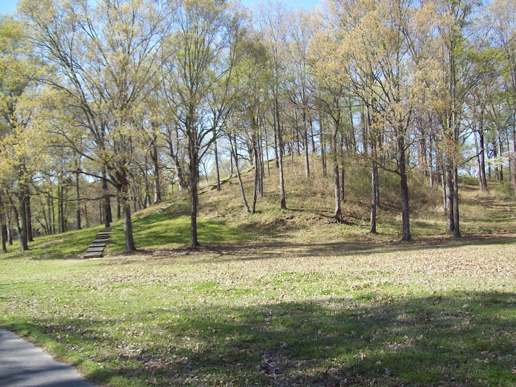
Poverty Point
32.6367° N · 91.4114° W · Archaeological Site
Photo: https://www.flickr.com/photos/15308454@N06/ Kniemla · CC BY-SA 2.0 · Wikimedia Commons
Poverty Point is a prehistoric site of the Poverty Point culture in northeastern Louisiana, United States. Named a UNESCO World Heritage Site in 2014. The free Lokali audio guide runs 7 minutes.
✓ Published October 2026 · how we write these guides
Visitor facts
| Lokali audio guide | 7 min · free |
|---|---|
| Type | Archaeological Site |
| Location | West Carroll Parish, United States |
| Coordinates | 32.6367, -91.4114 |
| Official website | nps.gov |
| Languages | 50+, in the Lokali app |
The story
Listen for a moment. The wind moves through tall grass, and somewhere below the bluff the water of Bayou Macon slides past, slow and brown. Underfoot the ground feels soft, almost springy. It looks like ordinary Louisiana farmland, gently rolling, scattered with oaks. But those low swells in the grass are not natural. Every one of them was carried here by hand, basket by basket, more than three thousand years ago.
You are standing at Poverty Point, in the northeast corner of Louisiana. Today it is a state historic site and a national monument. In 2014 it was also named a UNESCO World Heritage Site. That puts it in the same company as the pyramids of Egypt and the temples of Angkor. And yet many people who live only a few hours away have never heard of it. Part of the reason is simple. There is no stone here, no temple, no carved face. There is only earth, shaped with astonishing purpose.
Archaeologists date the main construction to roughly 1700 to 1100 before the common era. Think about that span for a moment. When these ridges were rising, the Bronze Age was still under way across the Mediterranean. Rome did not yet exist, not even as a village. The people who built this place lived along the lower Mississippi valley, long before European ships, long before horses returned to the Americas.
Here is the first surprise. The builders were not farmers. They did not plant corn or tend crops in the way later peoples of this region did. They were hunter-gatherers. They fished the bayous, hunted deer and waterfowl, and gathered nuts, seeds and roots from the forest. For a long time, scholars believed that only farming societies could organise labour on this scale. Poverty Point turned that idea upside down.
Now look out across the site and try to picture it from above. Six long earthen ridges curve in concentric arcs, one inside the next, like the rings of a half-opened shell. Together they form a giant C shape that opens toward the bayou. Today the ridges are low and worn, softened by centuries of rain and later ploughing. You may need to look carefully to trace them. Originally they stood higher, and archaeologists think people may have lived on top of them.
Inside the curve lies a wide, flat plaza. It looks empty now, just mown grass. But excavations here have found traces of large rings of wooden posts, set into the ground and later removed. Nobody knows exactly what these circles were for. They may have marked ceremonies, gatherings, or the movement of the sun and seasons. The plaza was not idle space. It was likely the heart of the whole design.
To the west rises the largest earthwork, known simply as Mound A. It is one of the biggest earthen mounds in North America. Some researchers have suggested its outline resembles a bird with outspread wings, though that reading is debated. What is more striking is how it was made. Studies of its soil layers suggest it went up remarkably quickly, possibly within a matter of months. That means a great many people working together, with no draft animals and no wheels, only their hands and baskets.
Other mounds stand across the landscape too. There is a smaller mound north of the ridges, and further away lies Motley Mound. To the south, Lower Jackson Mound is older still, built long before the ridges themselves. The builders may have known it as an ancient place even in their own time. It is a quiet reminder that, even for them, this landscape already held memories.
Here is the second surprise, and it concerns stone. The soil of this part of Louisiana has almost none. Yet archaeologists have found tools and ornaments made from materials carried in from far away. Copper came from the Great Lakes region. Soapstone came from the southern Appalachian mountains. Other stone travelled from the Ozark and Ouachita uplands. These goods moved across hundreds of kilometres, hand to hand, along rivers and trails. Poverty Point sat at the centre of a remarkable trading web.
Without local stone, people found another way to cook. They shaped small balls of clay, pressed and rolled in their palms, and baked them hard. Heated in a fire and placed in an earth oven, these clay pieces held warmth and cooked food slowly. Archaeologists call them Poverty Point objects, and they have been found here by the thousands. Some show the marks of fingers and palms. When you see them in the museum, look closely. You may be looking at the handprint of someone who lived over three thousand years ago.
And the name itself? It has nothing to do with the ancient people. It comes from a plantation that occupied this land in the nineteenth century. For generations, farmers ploughed across the ridges without realising what they were. Only in the twentieth century, when aerial photographs revealed the full shape from the sky, did the scale of the design become clear. Something this large was easiest to see from far above.
Today you can walk the trails, climb an observation tower for a wider view, and visit the museum near the entrance. In warmer seasons there may also be a guided tram ride around the grounds. Take your time. The earthworks reward slow looking. Morning and late afternoon light falls low across the grass, and that is when the gentle rise of each ridge shows most clearly as a soft line of shadow.
Before you leave, stand still once more and look toward the bayou. The water still runs where it ran for the builders. The same kinds of birds still cross the sky. The ridges under your feet were raised by people who left no writing and no names, only this patient shaping of the land. As you walk back to the car, notice how the ground rises and falls beneath you. Every small slope here is a trace of someone's work.
Key facts
What to look for
Practical tips
Common questions
Is there a free audio guide to Poverty Point?
Yes — the Lokali app narrates Poverty Point free of charge in 50+ languages. The guide runs about 7 minutes, covers the history, what to look for on site and practical tips, and works offline once downloaded.
Where is Poverty Point?
Poverty Point is near West Carroll Parish, United States, at 32.6367, -91.4114. Tap the map link on this page for directions from where you are.
What is Poverty Point known for?
Named a UNESCO World Heritage Site in 2014. Built roughly 1700 to 1100 before the common era.
What should you look for at Poverty Point?
Six low curved ridges forming a giant C shape. Fingerprints pressed into baked clay cooking objects. The steep profile of Mound A west of the ridges.
What should you know before visiting Poverty Point?
Start at the museum to understand the layout first. Climb the observation tower to see the ridge pattern.
When is the best time to visit Poverty Point?
Visit in early morning or late afternoon for shadows.
On the map
Opens directions to Poverty Point from your location.
Hear Poverty Point in your language
The full story, narrated, in 50+ languages. Download it before you go and it plays offline, at your own pace, with no ticket and no tour group.