
Freedom Trail
42.3600° N · 71.0568° W · Tourist Attraction
Photo: Ingfbruno · CC BY-SA 3.0 · Wikimedia Commons
Freedom Trail is a historical walking trail in Boston, Massachusetts. The trail links sixteen historic sites over about four kilometres. The free Lokali audio guide runs 7 minutes.
✓ Published October 2026 · how we write these guides
Visitor facts
| Lokali audio guide | 7 min · free |
|---|---|
| Type | Tourist Attraction |
| Location | Boston, United States |
| Coordinates | 42.3600, -71.0568 |
| Official website | thefreedomtrail.org |
| Languages | 50+, in the Lokali app |
The story
Look down at your feet. A line of red brick runs along the pavement, set into the sidewalk and, in places, painted onto it. It bends around corners and crosses busy streets. It slips between office towers and old burial grounds. Follow it, and it will carry you through the story of how a small colonial port turned against an empire. This is the Freedom Trail, and the ground under your shoes is the guide.
The trail runs for about four kilometres, linking sixteen historic sites across downtown Boston, the North End, and Charlestown. It is not one monument. It is a route... a walking thread that ties churches, meeting halls, graveyards, a ship, and a granite obelisk into a single afternoon. The idea came in 1951 from a local journalist, William Schofield. He wanted visitors to find the city's revolutionary landmarks without getting lost in its crooked streets. The red line was the answer.
Most people begin at Boston Common. This open green is one of the oldest public parks in America, set aside in the 1630s. Before it was a place for picnics and protests, it was shared grazing land for cattle. British soldiers camped here during the occupation of the town. Today you will hear dogs, joggers, and street musicians. Stand still for a moment, though, and picture the tents of redcoats spread across this same grass.
Lift your eyes to the hill above the Common. The gold dome you see crowns the Massachusetts State House, designed by Charles Bulfinch and completed at the end of the eighteenth century. The dome was later covered in copper by Paul Revere's company, and then in gold leaf. Here is a detail many visitors miss — during the Second World War, the dome was painted over. Officials feared its shine would guide enemy aircraft at night.
Walk on, and the trail leads you into quieter ground. The Granary Burying Ground sits behind an iron fence, its slate headstones leaning at odd angles. Some of the most famous names of the Revolution rest here. Paul Revere. Samuel Adams. John Hancock, whose signature on the Declaration of Independence is so large it became an English word for any signature. Look closely at the old stones. Many carry winged skulls, a common Puritan symbol of death and the soul's flight.
A few steps away stands King's Chapel, built from dark, rough granite. It looks heavy and unfinished — and in one way it is. The plans included a tall steeple that was never built, because the money ran out. Next to it lies another old burying ground, among the oldest in the city. The contrast is striking. Glass towers rise on every side, but these grey stones keep a colonial silence.
Further along, the trail reaches the Old South Meeting House, a brick church with a white steeple. In December 1773, thousands of colonists crowded inside to argue about a tax on tea. When the meeting ended, a group of men went down to the harbour and dumped chests of tea into the water. History remembers it as the Boston Tea Party. It began with speeches under this roof.
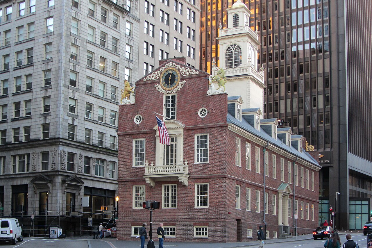
Now look for a small brick building with a lion and a unicorn on its roof. This is the Old State House, the seat of the colonial government. The lion and unicorn are symbols of the British crown. In 1776, the Declaration of Independence was read aloud from its balcony to the crowd below. Then, in the street, a circle of cobblestones marks the site of the Boston Massacre of 1770. British soldiers fired into a crowd, and five colonists died. Stand on that spot, and the traffic noise feels a little different.
The trail then reaches Faneuil Hall, a brick market hall topped with a golden grasshopper weathervane. For centuries this has been a place of trade downstairs and public debate upstairs. Colonists gathered here to speak against British rule, and it earned the nickname the Cradle of Liberty. Today the area around it fills with food stalls, street performers, and the smell of chowder and fried dough. Commerce and politics still share the same address.
Cross into the North End, the city's old Italian neighbourhood, and the streets narrow. Here you will find the Paul Revere House, a small wooden home from the late seventeenth century. It is the oldest building still standing in downtown Boston. Revere was a silversmith, a father of many children, and a messenger for the patriot cause. His home is modest. It is a useful reminder that the Revolution was made by working people, not only by statesmen.
Nearby, the tall white steeple of the Old North Church rises above the rooftops. On the night of April 18, 1775, two lanterns were hung in this steeple. They signalled that British troops were crossing by water toward Lexington and Concord. The poet Henry Wadsworth Longfellow later turned that night into a famous poem. Inside, the high white box pews still have little doors, built so families could keep warm in winter.
From the North End, the trail crosses the river into Charlestown. There, at the Navy Yard, floats the USS Constitution, launched in the 1790s. She is the oldest commissioned warship still afloat anywhere in the world. Her nickname is Old Ironsides. Sailors gave it to her when cannonballs seemed to bounce off her thick oak hull during the War of 1812. The ship is still crewed by active-duty sailors of the United States Navy.
The trail ends on a hill with a granite obelisk. The Bunker Hill Monument marks a battle fought in June 1775. Here is one more surprise — most of the fighting actually took place on nearby Breed's Hill, where the monument now stands. The colonists lost the ground, but they showed the British army that this war would not be short. If your legs allow, a narrow staircase of nearly three hundred steps climbs to a view across the harbour.
When you look back from here, you can trace the whole walk in your mind. The gold dome. The leaning slate stones. The lion and unicorn. The two lanterns. The ship's dark hull. Between them runs that simple red line, still set in the pavement under ordinary city life. As you walk away, watch for it at a crossing or a corner. It keeps leading the next visitor forward... one brick at a time.
Key facts
What to look for
Practical tips
Common questions
Is there a free audio guide to Freedom Trail?
Yes — the Lokali app narrates Freedom Trail free of charge in 50+ languages. The guide runs about 7 minutes, covers the history, what to look for on site and practical tips, and works offline once downloaded.
Where is Freedom Trail?
Freedom Trail is in Boston, United States, at 42.3600, -71.0568. Tap the map link on this page for directions from where you are.
What is Freedom Trail known for?
The trail links sixteen historic sites over about four kilometres. Journalist William Schofield proposed the route in 1951.
What should you look for at Freedom Trail?
The red brick line set into the sidewalk. Winged skull carvings on Granary Burying Ground headstones. Lion and unicorn statues on the Old State House roof.
What should you know before visiting Freedom Trail?
Wear comfortable shoes for long stretches of brick and cobblestone. Start at Boston Common and walk north toward Charlestown.
On the map
Opens directions to Freedom Trail from your location.
More to see in Boston


Hear Freedom Trail in your language
The full story, narrated, in 50+ languages. Download it before you go and it plays offline, at your own pace, with no ticket and no tour group.