
Uaxactun
17.3936° N · 89.6345° W · Archaeological Site
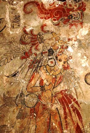
Photo: Clemens Schmillen · CC BY-SA 4.0 · Wikimedia Commons
Uaxactun is an ancient sacred place of the Maya civilization, in present-day Guatemala. The name Uaxactun means roughly "eight stone" in Maya. The free Lokali audio guide runs 6 minutes.
✓ Published October 2026 · how we write these guides
Visitor facts
| Lokali audio guide | 6 min · free |
|---|---|
| Type | Archaeological Site |
| Location | Flores, Guatemala |
| Coordinates | 17.3936, -89.6345 |
| Languages | 50+, in the Lokali app |
The story
The road narrows past Tikal. Pale limestone dust rises behind the wheels, and the forest closes in on both sides. Then the trees open, and you find an old grass airstrip with a small village along its edges. Chickens cross the path. Somewhere a radio plays. And just beyond the houses, under the canopy, the ruins of one of the oldest Maya cities in this region rise from the ground.
Welcome to Uaxactun. Say it slowly: wash-ak-TOON. You are deep in the Petén, the great lowland forest of northern Guatemala. The island town of Flores sits a few hours to the south. Tikal lies a short distance behind you. But Uaxactun feels very different from its famous neighbour. There are fewer people here. The paths are quieter. And the place still has a living village built right beside its temples.
Here is the first surprise. Uaxactun is not the city's ancient name. It is a modern invention. The American archaeologist Sylvanus Morley visited in the early twentieth century and found a carved stone monument with a very early date. In Maya languages, the name he chose means roughly "eight stone". It points to the eighth great cycle of the Maya calendar, the period of that early inscription. So the name itself is a scholar's label, built from a date.
In the decades that followed, the Carnegie Institution of Washington sent teams here to dig. Their work became a foundation for Maya archaeology. Before Uaxactun, scholars had only a vague picture of how Maya cities grew over time. The layers of pottery and buildings found here helped them sort the centuries into an order. Many textbooks that describe early Maya history still rest, in part, on what those teams found in this forest.
Now walk toward the cluster of buildings known as Group E. This is the heart of the visit, and it holds the second surprise. On the west side stands a low, stepped pyramid. Facing it, across an open plaza, is a long platform with three small temples on top. Stand on the pyramid and look east. The sunrise moves along that platform through the year, reaching the end temples around the solstices and the middle one around the equinoxes.
This arrangement was important enough that archaeologists named a whole type of building after it. Today, similar layouts across the Maya world are called "E-Groups" — named after this very plaza. Scholars still debate how precise these sightlines really are. Some see them as true observatories. Others see them as ceremonial stages tied to the farming calendar. Either way, the people who built this place clearly watched the sky, and they shaped stone to match its rhythm.
Look closely at the pyramid itself. The early excavators found an older building hidden inside a later one. Maya builders often did this. They did not tear down an old temple. They covered it with a new, larger shell. When the outer layers were cleared here, the inner structure appeared, decorated with large modelled faces in plaster. Those masks flank the stairways. They are among the best reasons to come all this way.
Take a moment with them. The plaster was shaped by hand, more than two thousand years ago by many estimates. The faces are heavy and rounded, with deep eyes and wide mouths. Experts connect them to gods and to the power of early rulers. Rain, sun, and centuries of roots have worn them, and some have been protected or restored. Still, you are looking at the work of artists from the early days of Maya kingship.
Uaxactun and Tikal stood close together, and their histories became tangled. Inscriptions from the region describe dramatic events in the late fourth century, around the year 378. Many scholars link them to the arrival of powerful newcomers connected with Teotihuacan, the great city in central Mexico. After this time, Uaxactun seems to fall under Tikal's shadow. The exact story is still debated. But the idea of two neighbours, one rising over the other, runs through the record.
Now look around at the village. Here is something many visitors miss. The people of Uaxactun live inside the Maya Biosphere Reserve, a huge protected area covering much of northern Petén. The community manages a forest concession. Families here harvest xate, a decorative palm leaf sold abroad for flower arrangements. Older generations tapped chicle, the natural gum from sapodilla trees that once went into chewing gum around the world. The forest is not only scenery here. It is work.
That grass strip running through the village tells another story. It was once an airstrip, a lifeline before roads reached this far. Archaeologists, gum tappers and supplies all came in by air. Today, children play on it and horses graze along its edges. The ruins sit on low hills around this open space, so you move between ancient plazas and ordinary village life within a few minutes of walking.
Listen as you walk between the groups of buildings. Howler monkeys may call from the canopy — a deep, rolling roar that carries a long way. Parrots cross overhead in noisy pairs. Leafcutter ants march along the trails, carrying green fragments. In the wet season, the air is heavy and the mud is thick. In the dry months, dust coats your shoes. The forest here is always present, always pressing at the edges of the stone.
Before you leave, return to the plaza of Group E. Stand where the ancient watchers may have stood, and face east toward the three small temples. Notice how low they are, and how the land falls quiet around them. Then turn and look back at the village, at the smoke from a cooking fire, at the airstrip grass moving in the wind. Two ways of living with this forest, side by side. Take that view with you as you go.
Key facts
What to look for
Practical tips
Common questions
Is there a free audio guide to Uaxactun?
Yes — the Lokali app narrates Uaxactun free of charge in 50+ languages. The guide runs about 6 minutes, covers the history, what to look for on site and practical tips, and works offline once downloaded.
Where is Uaxactun?
Uaxactun is near Flores, Guatemala, at 17.3936, -89.6345. Tap the map link on this page for directions from where you are.
What is Uaxactun known for?
The name Uaxactun means roughly "eight stone" in Maya. Sylvanus Morley named the site after an early dated monument.
What should you look for at Uaxactun?
Large plaster masks flanking the stairways of the Group E pyramid. Three small temples in a row on the eastern platform. The old grass airstrip running through the village.
What should you know before visiting Uaxactun?
Combine your visit with Tikal, which lies on the same route. Bring insect repellent and long sleeves for forest trails.
When is the best time to visit Uaxactun?
Wear sturdy shoes; trails turn muddy in the wet season.
On the map
Opens directions to Uaxactun from your location.
More to see near Uaxactun



Hear Uaxactun in your language
The full story, narrated, in 50+ languages. Download it before you go and it plays offline, at your own pace, with no ticket and no tour group.