
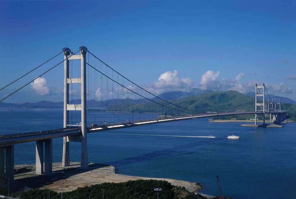
Photo: Exploringlife · CC BY-SA 4.0 · Wikimedia Commons
Stonecutters Bridge is a bridge in Hong Kong. Main span between the towers exceeds one kilometre. The free Lokali audio guide runs 7 minutes.
✓ Published October 2026 · how we write these guides
Visitor facts
| Lokali audio guide | 7 min · free |
|---|---|
| Type | Bridge |
| Location | Hong Kong, China |
| Coordinates | 22.3261, 114.1183 |
| Languages | 50+, in the Lokali app |
The story
Listen first. Out on the water, a container ship slides past with a low, steady hum. Gulls call above the channel. Then, from high overhead, comes the soft rush of traffic, carried on a thin grey ribbon strung between two needles of steel. The air smells of salt and diesel, and the light bounces off the water in hard, bright flashes. This is Stonecutters Bridge, and it is one of the few places in Hong Kong where the scale of the port feels truly human-sized... and then suddenly, not at all.
The bridge crosses the Rambler Channel. On one side is Tsing Yi, an island of housing estates, oil depots and industry. On the other is Stonecutters Island, low and flat, at the western edge of Kowloon. Between them runs one of the busiest shipping lanes in Asia. The bridge carries part of Route 8, a highway that links the airport side of Hong Kong with Sha Tin and the eastern New Territories. Drivers cross it in less than a minute. Most of them barely look up.
Here is the first surprise. Stonecutters Island is not really an island any more. For much of its history it sat alone in the harbour, separated from Kowloon by open water. Then, during the large land reclamation projects of the late twentieth century, Hong Kong filled in the sea around it. Today the old island is joined to the mainland, and its name is a memory of a coastline that no longer exists. The bridge, in a sense, connects one former island to another.
The name itself comes from stone. For generations, workers cut granite here. Hong Kong is built on granite, and the grey rock you see in old sea walls and steps across the city came from quarries like this one. Later, the island became a military area. Britain took control of it in 1860, together with the southern tip of Kowloon. For most of the next century and more, ordinary people could not go there. It stayed quiet, fenced and mostly unseen.
Now look at the towers. There are two of them, one on each side of the channel, and each one rises almost three hundred metres above the water. That is taller than many of the skyscrapers you see around the harbour. Notice that they are not shaped like an H or an A, as many big bridges are. Each tower is a single tall column. It narrows as it climbs, like a pencil sharpened very slowly, and it ends in a clean point against the sky.
The second surprise is in that top section. The lower part of each tower is concrete. But the upper part has an outer skin of stainless steel. On a clear day, especially in the morning or late afternoon, that steel catches the light and shines a little brighter than the grey concrete below. Look closely and you can often see the line where one material gives way to the other. It is a small detail, and most people who drive across the bridge never notice it.
From each tower, cables fan out and down to hold the road deck. This kind of structure is called a cable-stayed bridge. In a suspension bridge, the road hangs from two great main cables that sweep between the towers. Here, there are no main cables. Instead, many straight cables run directly from the tower to the deck, like the strings of a harp. The result looks lighter and more open. From below, the cables seem to draw lines of perspective across the sky.
The main span, the open stretch of road between the two towers, is more than one kilometre long. When the bridge opened at the end of 2009, it was one of the longest cable-stayed spans in the world. Why so long? Because of the ships. The engineers could not place a support in the middle of the channel. Container vessels pass underneath day and night, heading to and from the terminals at Kwai Chung and Tsing Yi. The channel had to stay clear, and the deck had to sit high enough for tall ships to pass.
The design came out of an international competition. The winning idea had to solve a hard local problem: typhoons. Hong Kong sits in the path of tropical storms, and a long, thin bridge deck can move dangerously in strong wind. So the deck here is not one solid box. It is split into two parallel sections, joined by cross beams, with a gap running down the middle. Wind can pass through that gap. This helps the deck stay calm when the storms come in from the South China Sea.
Now turn and look at what surrounds the bridge. Rows of cranes stand along the waterfront, painted in reds, blues and greys. Stacks of shipping containers rise in coloured blocks. Tugboats push and pull. This is the working heart of Hong Kong's port, and the bridge was built to serve it. In many cities, a great bridge sits in a postcard setting. Here it sits in the middle of an industrial landscape — and that is part of its character.
You cannot walk across Stonecutters Bridge. It is a highway, open only to vehicles. The best way to appreciate it is from the shore. The waterfront paths on Tsing Yi give long, clear views of the towers and the whole span. You can also see it from higher ground and from some trains and buses crossing the area. At night, lights trace the outline of the towers and the deck, and the reflections stretch across the dark water of the channel.
It is worth thinking for a moment about what this structure means for the city. Hong Kong is a place of islands, channels and steep hills. For a long time, moving between these pieces of land meant ferries and long detours. Bridges like this one stitched the territory together. A trip that once took a long time now takes minutes. Life here depends on those connections, for workers, for goods, and for the steady flow of trade through the port.
Before you go, look up once more. Find the point where concrete turns to steel near the top of the nearest tower. Follow one cable with your eyes, from the tower down to the deck. Then listen again: the ships below, the traffic above, the wind off the water. When you walk away, notice how often the towers appear between buildings and over rooftops, still in view. The bridge stays with you for a long time after you leave the water's edge.
Key facts
What to look for
Practical tips
Common questions
Is there a free audio guide to Stonecutters Bridge?
Yes — the Lokali app narrates Stonecutters Bridge free of charge in 50+ languages. The guide runs about 7 minutes, covers the history, what to look for on site and practical tips, and works offline once downloaded.
Where is Stonecutters Bridge?
Stonecutters Bridge is in Hong Kong, China, at 22.3261, 114.1183. Tap the map link on this page for directions from where you are.
What is Stonecutters Bridge known for?
Main span between the towers exceeds one kilometre. Opened to traffic at the end of 2009.
What should you look for at Stonecutters Bridge?
The line where concrete meets steel on each tower. Harp-like cables fanning down from each single tower. Gap running down the middle of the split deck.
What should you know before visiting Stonecutters Bridge?
Walk the Tsing Yi waterfront paths for full-span views. Come in late afternoon when the steel catches light.
When is the best time to visit Stonecutters Bridge?
Stay for dusk to see the bridge lighting appear.
On the map
Opens directions to Stonecutters Bridge from your location.
More to see in Hong Kong


Hear Stonecutters Bridge in your language
The full story, narrated, in 50+ languages. Download it before you go and it plays offline, at your own pace, with no ticket and no tour group.