
Seuthopolis
42.6181° N · 25.3056° E · Archaeological Site
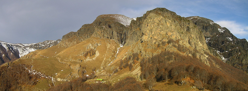
Photo: Aniket Mone (http://www.aniketmone.com) · CC BY 2.0 · Wikimedia Commons
Seuthopolis is an archeological site in Bulgaria. Founded by Odrysian king Seuthes the Third, late fourth century BCE. The free Lokali audio guide runs 7 minutes.
✓ Published October 2026 · how we write these guides
Visitor facts
| Lokali audio guide | 7 min · free |
|---|---|
| Type | Archaeological Site |
| Location | Kazanlak, Bulgaria |
| Coordinates | 42.6181, 25.3056 |
| Languages | 50+, in the Lokali app |
The story
Stand at the edge of the water and listen. Small waves move against the stones of the shore. Wind comes down from the Balkan Mountains to the north, and it carries the smell of reeds and wet earth. The surface in front of you is calm and grey-green. It looks like an ordinary reservoir. Somewhere beneath it, though, lies the plan of a whole Thracian city. Its streets, houses and royal palace are under the water.
This drowned city is Seuthopolis. Its name means, quite simply, the city of Seuthes. It was the royal seat of Seuthes the Third, a king of the Odrysians. The Odrysians were the most powerful of the Thracian peoples, the tribes who lived across much of what is now Bulgaria in the ancient world. The city was founded in the late fourth century before Christ. That was the era just after Alexander the Great, when his generals were dividing his empire between them.
To understand why a Thracian king built a Greek-style city, picture the politics of the time. Seuthes ruled in the shadow of Macedon, the kingdom of Alexander. He fought against Lysimachus, one of Alexander's successors, and he also made agreements with him. Seuthopolis was a statement. It showed that a Thracian ruler could build a planned, walled capital in the Hellenistic style. Hellenistic means the Greek-influenced culture that spread across the eastern Mediterranean after Alexander.
And now, the first surprise. For more than two thousand years, nobody knew exactly where this city stood. It was found almost by accident in 1948. Workers were preparing the ground for a new dam on the Tundzha River, and archaeologists were called to examine the site before the valley flooded. What they uncovered was far more than a scatter of pottery. It was the outline of a complete fortified town.
The excavations ran for several years into the early 1950s. The archaeologists mapped a city laid out on a regular grid. Its streets crossed at right angles, in the manner of Greek town planning. Strong stone walls surrounded the whole settlement. Inside, the excavators found houses built around courtyards, a central square, and a fortified royal residence. That residence stood in one corner of the city, protected by its own inner walls.
The royal quarter held another important discovery — a long inscription carved in Greek. Scholars often call it the Great Inscription of Seuthopolis. It mentions King Seuthes and his wife, Queen Berenike, and their sons. It is a rare document, because the Thracians left very few written texts of their own. Most of what we know about them comes from Greek writers, from tombs, and from objects buried in the ground. Here, for once, a Thracian royal family appears by name.
The inscription also refers to a sanctuary of the Great Gods. These were mystery deities, worshipped through secret rites. Their best-known shrine stood on the island of Samothrace in the northern Aegean. Their presence here shows that the court of Seuthes looked south toward the Greek world for its religion as well as its architecture. Yet the city still kept its own Thracian character, and Thracian kings were never simply copies of Greek rulers.
Then came the second surprise, and it is the reason you cannot walk these streets today. Once the excavations ended, the dam was completed. The valley filled with water, and Seuthopolis disappeared beneath the reservoir. The decision was made in a very different time, when building new infrastructure often came first. Many of the finds were moved to museums before the water rose. The foundations themselves stayed where they were, under the lake.
Over the decades, several people have proposed ways to bring the city back into view. One widely discussed idea imagined a ring-shaped wall in the reservoir, which would hold back the water around the site. Visitors could then walk down among the ruins. Plans like this have come up more than once, but the city remains underwater. So when you stand here, you are looking at a lake. You are not looking at an open-air site.
That may feel strange at first. But it is worth staying a few minutes. Look out across the surface and try to picture a walled town of stone and clay. Smoke would rise from household fires, and traders would arrive along the river valley. The hills around you are the same hills the people of Seuthopolis saw. The Balkan range still rises to the north. The gentler slopes of the Sredna Gora mountains lie to the south.
This valley between those two ranges is often called the Valley of the Thracian Kings. It is also the Rose Valley, famous for the oil-bearing roses grown here for perfume. Around Kazanlak, the fields are scattered with burial mounds. Each mound is a man-made hill raised over an ancient tomb. Many of them belonged to the Thracian elite of roughly the same era as Seuthopolis. The city and the mounds belong to one landscape of power and memory.
One of these mounds is directly linked to the king himself. In the early 2000s, archaeologists excavated a large tomb in the valley and found a bronze head of a bearded man. Most scholars identify it as a portrait of Seuthes the Third. It is a powerful object, with deep-set eyes and a heavy, serious face. So the founder of this drowned city has a face we can still look at today, even though his streets lie underwater.
If you want to see what came out of Seuthopolis, the museums in and around Kazanlak are the natural next step. They are the places where the objects and the story come together. The famous painted Thracian tomb of Kazanlak is also nearby, and it is listed by UNESCO. Together, these places help to fill the empty surface of the lake with images. You will see pottery, coins, and the faces of the people who lived here.
Before you leave, look once more at the water. Notice how the light changes as clouds pass over the mountains. Listen again to the small waves against the shore. Beneath that quiet surface lie the walls and streets of a king's city, still in their places. As you turn back toward Kazanlak, the burial mounds will appear along the road. They are the visible part of the same story — the part that stayed above the water.
Key facts
What to look for
Practical tips
Common questions
Is there a free audio guide to Seuthopolis?
Yes — the Lokali app narrates Seuthopolis free of charge in 50+ languages. The guide runs about 7 minutes, covers the history, what to look for on site and practical tips, and works offline once downloaded.
Where is Seuthopolis?
Seuthopolis is near Kazanlak, Bulgaria, at 42.6181, 25.3056. Tap the map link on this page for directions from where you are.
What is Seuthopolis known for?
Founded by Odrysian king Seuthes the Third, late fourth century BCE. Discovered in 1948 during construction of a dam.
What should you look for at Seuthopolis?
The Balkan Mountains rising along the northern horizon. Gentler Sredna Gora slopes across the southern side. Grassy burial mounds scattered across the surrounding fields.
What should you know before visiting Seuthopolis?
Pair this stop with Kazanlak museums to see recovered finds. Visit the nearby painted Thracian tomb of Kazanlak.
On the map
Opens directions to Seuthopolis from your location.
More to see in Kazanlak


Hear Seuthopolis in your language
The full story, narrated, in 50+ languages. Download it before you go and it plays offline, at your own pace, with no ticket and no tour group.