
Ischigualasto Provincial Park
30.1168° S · 67.9118° W · Park
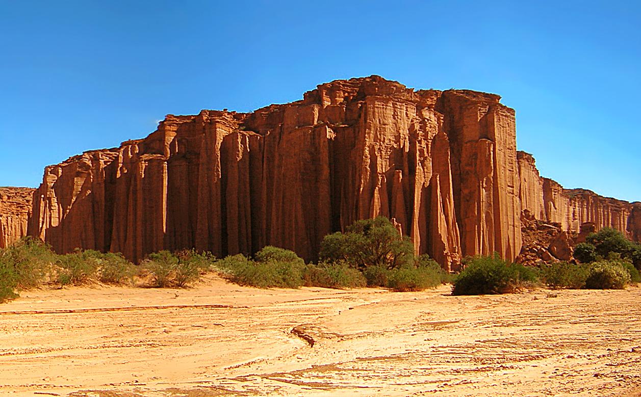
Photo: user:idobi · CC BY-SA 3.0 · Wikimedia Commons
Ischigualasto Provincial Park is a provincial park in San Juan province, Argentina. Rock layers date from the Triassic, about 230 million years ago. The free Lokali audio guide runs 8 minutes.
✓ Published October 2026 · how we write these guides
Visitor facts
| Lokali audio guide | 8 min · free |
|---|---|
| Type | Park |
| Location | San Juan, Argentina |
| Coordinates | -30.1168, -67.9118 |
| Languages | 50+, in the Lokali app |
The story
Listen for a moment. The wind moves across the open ground, and fine grit taps against your shoes. The air is dry enough to feel on your lips. Around you, the land is pale grey, then ochre, then a deep rust red in the distance. Nothing here is tall and green. The light falls hard and clean, and every ridge throws a sharp shadow. You are standing in Ischigualasto, in the northeast of Argentina's San Juan Province. Many people call it by a simpler name: the Valley of the Moon.
That nickname makes sense the moment you look around. The ground is bare, eroded, and strangely sculpted. But the name hides the real story. This is not a lunar landscape. It is a very old earthly one. The layers of rock around you were laid down during the Triassic period. That is the first chapter of the age of dinosaurs, roughly 230 million years ago. Few places on Earth show this moment in time so clearly, and so openly, right at the surface.
Here is the first surprise. In the Triassic, this valley was not a desert. It was a wide basin with rivers, lakes, and seasonal floods. Rain came in pulses. Plants grew along the water. Over long ages, mud, sand, and volcanic ash settled in thin layers, one on top of another. Animals died, and some of their bones were buried quickly in that sediment. Today, wind and the occasional hard rain strip those layers back, and the old floodplain comes slowly into view again.
This is why scientists come here from around the world. The rocks of the valley hold some of the earliest known dinosaurs. One of them is Herrerasaurus, a meat-eater that walked on two legs. It carries the name of Victorino Herrera, a local goat herder who found the first remains. Another is Eoraptor, a small, light animal described by researchers in the 1990s. These creatures were not giants. They were early experiments, living beside many other reptiles that were larger and far more common at the time.
That is the second surprise, and it changes how you see the valley. Dinosaurs were not yet in charge here. The ground was shared with crocodile-like hunters, with plant-eating reptiles that had beaks and tusks, and with animals related to the ancestors of mammals. Ischigualasto captures a world before the dinosaurs took over. For researchers, it is like finding a family album from the years before a famous person became famous. The early pages show where everything began.
In 2000, this park was added to the UNESCO World Heritage list. UNESCO is the cultural agency of the United Nations, and the list protects places of outstanding value to all people. Ischigualasto shares that listing with Talampaya National Park, just across the border in La Rioja Province. Together, the two parks cover a long, continuous record of Triassic life. Talampaya is known for its high red canyon walls. Ischigualasto is known above all for its fossils and its wide, open badlands.
The name Ischigualasto itself is older than the park. It is often said to come from an Indigenous language of the region, but its exact meaning is debated. Some sources give poetic translations, and you may hear several versions from guides. It is honest to say that nobody can confirm one meaning with certainty. What is certain is that people lived and travelled across this harsh country long before the scientists arrived, reading the land for water, shade, and safe passage.
Most visitors explore the valley on a set circuit of dirt road, a loop of several dozen kilometres. In many cases, cars travel together in a slow convoy, led by a park ranger. The group stops at key formations, and the ranger explains what you see. This system protects the fragile ground. It also keeps people safe in a place with no shade, no water, and very long distances between stops. Treat the ranger as your key to the valley. Ask questions.
Along the route, the rock takes on shapes that people have named over the years. One is called the Submarine, a long, narrow form that looks like a vessel rising out of the ground. Another is the Sphinx, a weathered block with a head-like top. Then there is the Mushroom, a heavy cap of hard rock balanced on a thinner stem. The cap protects the softer stone below it, so the wind carves away the base faster than the top.
Perhaps the strangest stop is a flat area known as the Bocce Court. Bocce is an Italian ball game, similar to bowls. Here, the ground is scattered with almost perfectly round stones, some the size of a fist and some much larger. They look placed by hand, but they are natural. Geologists call them concretions. Minerals gathered around a small core inside the sediment and grew outward in layers, over a very long time. Erosion then freed them from the softer rock.
Now look up toward the edges of the valley. On one side, you may see high red cliffs, glowing in the low sun. These are the Red Ravines, part of an older and different set of rock layers. Elsewhere, there are bands of purple, green-grey, and white. Each colour shows a change in the old environment: a wetter season, a layer of volcanic ash, a shift in the minerals carried by ancient rivers. The valley is a colour chart of deep time.
Near the entrance, there is a visitor centre with a small museum named after William Sill, a scientist who worked on the fossils of this area. Inside, you can see casts and displays of the animals found in the rocks around you. It is worth a visit before or after the circuit. Seeing the skeletons first helps your eyes on the drive. You start to imagine those animals crossing the same ground, under a very different sky.
The valley changes with the hour. At midday, the light is flat and harsh, and the colours seem bleached. Toward late afternoon, the reds deepen and the shadows grow long. Some evenings, the park offers special night visits when the moon is full. Under that pale light, the nickname becomes very easy to understand. The sky here is dark and wide, far from city lights, and the stars feel close. Dress in layers, because the desert cools quickly after sunset.
Before you leave, take one last look at the ground at your feet. That dust, those cracked grey layers, the small pebbles rolling in the wind... they are pieces of a floodplain that existed long before the first flowers on Earth. The rangers ask visitors not to touch or collect anything, and now you know why. Every storm uncovers a little more. Somewhere under your feet, perhaps, the next important discovery is still waiting, quietly, for the right rain.
Key facts
What to look for
Practical tips
Common questions
Is there a free audio guide to Ischigualasto Provincial Park?
Yes — the Lokali app narrates Ischigualasto Provincial Park free of charge in 50+ languages. The guide runs about 8 minutes, covers the history, what to look for on site and practical tips, and works offline once downloaded.
Where is Ischigualasto Provincial Park?
Ischigualasto Provincial Park is in San Juan, Argentina, at -30.1168, -67.9118. Tap the map link on this page for directions from where you are.
What is Ischigualasto Provincial Park known for?
Rock layers date from the Triassic, about 230 million years ago. Listed by UNESCO in 2000 alongside Talampaya National Park.
What should you look for at Ischigualasto Provincial Park?
Round stone concretions scattered across the Bocce Court. The heavy rock cap balanced on the Mushroom's thin stem. Bands of purple, grey, and white in the eroded slopes.
What should you know before visiting Ischigualasto Provincial Park?
Fill your fuel tank before reaching the park entrance. Carry plenty of water, sunscreen, and a wide-brimmed hat.
When is the best time to visit Ischigualasto Provincial Park?
Bring a warm layer for the fast evening temperature drop.
On the map
Opens directions to Ischigualasto Provincial Park from your location.
More to see near Ischigualasto Provincial Park
Hear Ischigualasto Provincial Park in your language
The full story, narrated, in 50+ languages. Download it before you go and it plays offline, at your own pace, with no ticket and no tour group.