
Loch Lomond and The Trossachs National Park
56.2500° N · 4.6167° W · National Park
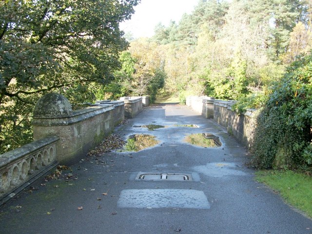
Photo: Postdlf · CC BY-SA 3.0 · Wikimedia Commons
Loch Lomond and The Trossachs National Park is a national park in Scotland. Scotland's first national park, established in 2002. The free Lokali audio guide runs 7 minutes.
✓ Published October 2026 · how we write these guides
Visitor facts
| Lokali audio guide | 7 min · free |
|---|---|
| Type | National Park |
| Location | Argyll and Bute, United Kingdom |
| Coordinates | 56.2500, -4.6167 |
| Official website | lochlomond-trossachs.org |
| Languages | 50+, in the Lokali app |
The story
Listen first. Water laps against shingle, a soft and constant sound. Somewhere out on the loch an outboard motor hums, then fades. The air smells of wet bracken, pine resin, and peat. If the cloud is low, the hills across the water appear and disappear like slow breathing. You are standing in a landscape that has drawn painters, poets, outlaws, and day-trippers for centuries. And it is far bigger than the single view in front of you.
This is Loch Lomond and The Trossachs National Park. It became Scotland's first national park in 2002. That may surprise you, given how old and settled these hills feel. England and Wales had national parks for half a century before Scotland created its own. The park stretches across several council areas, including Argyll and Bute, and it holds mountains, sea lochs, forests, and dozens of freshwater lochs. Loch Lomond is only the most famous part.
Let us begin with the water itself. Loch Lomond is the largest inland body of water in Great Britain by surface area. It is long and narrow in the north, where steep hills squeeze it into a fjord-like channel. In the south it opens out, wide and shallow, and scattered with wooded islands. Those two halves look so different for a reason — and the reason lies under your feet.
A great crack in the Earth's crust runs straight through the loch. Geologists call it the Highland Boundary Fault. It divides the Lowlands from the Highlands of Scotland. To the south, the rock is softer, and the land rolls gently. To the north, the rock is hard and ancient, and the mountains rise steeply. Ice sheets later scoured the valley deep. So when you look across the loch, you are looking across a geological border between two different Scotlands.
You can see the fault line in the islands. A chain of them, including Inchcailloch and Inchmurrin, lines up across the southern loch, following the line of the fault. Inchmurrin is often described as the largest freshwater island in the British Isles. Inchcailloch carries the remains of an old church and burial ground, and its name is usually translated as the island of the old women, or of the nuns. Small boats from the village of Balmaha make the short crossing.
On the eastern shore, one mountain dominates. This is Ben Lomond, the most southerly of Scotland's Munros. A Munro, for listeners outside Scotland, is a Scottish mountain over three thousand feet high. Walkers collect them, the way some people collect stamps. Ben Lomond is a popular first Munro, because its path is clear and its summit view is wide. On a clear day you look down the full length of the loch, and north into the Highlands.
Along that same eastern shore runs the West Highland Way, Scotland's best-known long-distance footpath. It starts on the edge of Glasgow and ends in Fort William, far to the north. Here it follows the lochside through oak woods and over rocky ground. You may see walkers with heavy packs, muddy boots, and tired smiles. Many of them have days of walking still ahead. A short climb that is popular with day visitors is Conic Hill, above Balmaha, which sits directly on the fault line.
Now turn east, towards the Trossachs. The name refers to a cluster of wooded hills and lochs, often called the Highlands in miniature. In the early nineteenth century, this area became one of the first places in Scotland to attract mass tourism. The cause was a poem. Sir Walter Scott, the Edinburgh novelist and poet, published The Lady of the Lake in 1810. He set it around Loch Katrine. Readers came in large numbers to see the scenery for themselves.
Loch Katrine has a second story that most visitors miss. Since the nineteenth century, it has supplied fresh water to the city of Glasgow. Queen Victoria opened the waterworks in 1859. Engineers carried the water by gravity through tunnels and aqueducts, without pumps, all the way to the city. When people in Glasgow turn on a tap, part of what they drink may have started here. On the loch, a steamship named after Walter Scott has carried passengers for well over a century.
These hills are also the country of Rob Roy MacGregor. He was a cattle dealer and outlaw of the late seventeenth and early eighteenth centuries. His clan, the MacGregors, lived under heavy legal persecution, and for a time even their name was banned. Walter Scott again turned real history into romance with his novel Rob Roy. Today the MacGregor story is wrapped in legend, and it is hard to separate fact from tale. His grave lies in the churchyard at Balquhidder, in the north of the park.
Then there is the song. You may know the chorus about taking the high road and the low road, and reaching Scotland before you. The Bonnie Banks of Loch Lomond is sung around the world. Its origins are uncertain. According to one popular tale, it is the song of a doomed Jacobite soldier. In the story, his spirit will travel home by the low road of the dead. It is a beautiful idea, but it remains folklore, not documented history.
A few practical notes, from someone walking beside you. The weather here changes fast, so carry a waterproof layer even on a bright morning. In summer, small biting insects called midges gather near still water at dawn and dusk. Repellent helps. On the western shore, the village of Luss offers stone cottages, a lochside pier, and an easy place to begin. If you want quiet, the eastern shore beyond Balmaha and the Trossachs back roads are usually calmer than the main road.
Before you move on, look again at the water. Notice where the islands line up, and remember the old crack in the Earth beneath them. Notice the change from soft green fields to dark, steep hills. Listen for the lap of the loch on the stones. Writers came here two centuries ago and gave the world a picture of Scotland. That picture still draws people today. Now it is your turn to take it home, in your own way.
Key facts
What to look for
Practical tips
Common questions
Is there a free audio guide to Loch Lomond and The Trossachs National Park?
Yes — the Lokali app narrates Loch Lomond and The Trossachs National Park free of charge in 50+ languages. The guide runs about 7 minutes, covers the history, what to look for on site and practical tips, and works offline once downloaded.
Where is Loch Lomond and The Trossachs National Park?
Loch Lomond and The Trossachs National Park is near Argyll and Bute, United Kingdom, at 56.2500, -4.6167. Tap the map link on this page for directions from where you are.
What is Loch Lomond and The Trossachs National Park known for?
Scotland's first national park, established in 2002. Loch Lomond is Britain's largest inland water by area.
What should you look for at Loch Lomond and The Trossachs National Park?
Islands lined up across the loch along the fault line. Contrast between soft southern fields and steep northern hills. West Highland Way walkers carrying heavy packs along the shore.
What should you know before visiting Loch Lomond and The Trossachs National Park?
Pack a waterproof layer even when the morning looks clear. Bring midge repellent for summer dawn and dusk visits.
When is the best time to visit Loch Lomond and The Trossachs National Park?
Pack a waterproof layer even when the morning looks clear.
On the map
Opens directions to Loch Lomond and The Trossachs National Park from your location.
More to see in Argyll and Bute



Hear Loch Lomond and The Trossachs National Park in your language
The full story, narrated, in 50+ languages. Download it before you go and it plays offline, at your own pace, with no ticket and no tour group.