
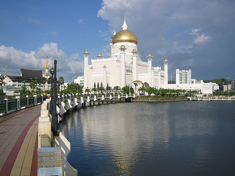
Sultan Haji Omar Ali Saifuddien Bridge
4.8863° N · 115.0835° E · Bridge
Photo: Peter L. Higgs · CC BY-SA 4.0 · Wikimedia Commons
Sultan Haji Omar Ali Saifuddien Bridge is a bridge in Brunei. Opened to traffic in March 2020. The free Lokali audio guide runs 8 minutes.
✓ Published October 2026 · how we write these guides
Visitor facts
| Lokali audio guide | 8 min · free |
|---|---|
| Type | Bridge |
| Location | Brunei |
| Coordinates | 4.8863, 115.0835 |
| Languages | 50+, in the Lokali app |
The story
Feel the tyres hum as the road leaves solid ground behind. On both sides, flat water stretches away, grey-green under a hazy tropical sky. Low mangrove forest marks the horizon, dark and unbroken. The air outside the window is warm and heavy with salt. Then two tall white towers rise ahead of you, fanned with steel cables. You are crossing Brunei Bay on the longest bridge in this small sultanate. For many years, nobody in Brunei could make this journey by car without leaving the country.
This is the Sultan Haji Omar Ali Saifuddien Bridge, which most people here simply call the Temburong Bridge. It opened to traffic in March 2020. Its total length is about thirty kilometres, and when it opened it was described as the longest bridge in Southeast Asia. That figure includes the long viaducts over water and over swamp forest, not only the sections you see from a distance. For a country of Brunei's size, it is an enormous structure.
To understand why it exists, look at a map of Brunei. The country is split into two separate pieces of land. The larger western part holds the capital, Bandar Seri Begawan, and most of the population. The eastern part is Temburong District, quiet and heavily forested. Between them lies a strip of Malaysian territory around the town of Limbang, in the state of Sarawak. Temburong is an exclave — a part of a country cut off from the rest of it by another country's land.
Before this bridge, the usual way to reach Temburong was by boat. Fast, narrow speedboats carried passengers from the capital through the mangrove channels to the small town of Bangar. The other option was to drive through Malaysia. That meant passing through several border checkpoints, with passports stamped in and out, just to travel between two districts of the same country. The bridge removed that problem. Today a car can cross from the Brunei-Muara side to Temburong in well under an hour.
The name honours Sultan Omar Ali Saifuddien the Third. He ruled Brunei through the middle of the twentieth century, and many Bruneians remember him as the architect of the modern state. He is the father of the present Sultan, Hassanal Bolkiah. You may already know his name from the golden-domed mosque in the capital, which is also named after him. Giving this crossing the same name links a modern piece of engineering to one of the country's most respected figures.
Now look at the shape of the bridge itself. Most of its length is a long, low concrete viaduct, carried on rows of piers standing in the bay. These sections are simple and repetitive. But at the points where ships need to pass underneath, the deck rises. Here the engineers used cable-stayed spans. In a cable-stayed bridge, straight steel cables run directly from tall towers down to the road deck, holding it up like the strings of a harp.
The construction was an international effort. Contractors from South Korea and China worked on different sections of the project, alongside Bruneian teams. Building in this place was not easy. The bay is shallow and tidal. The ground beneath it is soft. Deep foundations had to reach firm layers far below the mud. On the Temburong side, the route also had to cross areas of mangrove and peat swamp forest, which are fragile and very hard to rebuild once damaged.
Here is something many drivers do not notice. As you approach Temburong, the bridge does not simply land on the shore. It continues on stilts for a long distance above the swamp forest. This was a deliberate choice. Raising the road above the trees allowed water to keep flowing and wildlife to keep moving underneath. Builders worked from the already-completed deck as much as possible, so heavy machinery did not need to clear wide paths through the forest below.
That forest matters. The mangroves around Brunei Bay are home to proboscis monkeys, a species found only on the island of Borneo. The males have long, drooping noses and large round bellies, and they are often seen at dusk feeding in the treetops near the water. You are unlikely to see them from a moving car. But the boat trips that still run through the mangrove channels often find them. It is a strong reason to return to the water on another day.
The bridge has also changed life in Temburong. For decades the district was sparsely populated and slow-paced, and in many ways it still is. It is often called Brunei's green jewel. Much of it is rainforest, and it holds Ulu Temburong National Park, a protected area of steep, forested hills and fast rivers. Before the bridge, the journey there was part of the adventure. Now day trips are much easier, and more visitors arrive by road.
Some local people have mixed feelings about this. Easier access brings business to small shops and guesthouses in Bangar. It also brings more traffic to a place many families valued for its quiet. The speedboat operators, who once carried almost everyone, have fewer passengers now. A bridge that solves one problem can create new questions. Listen to people in Temburong talk about it, and you will often hear both pride and a little nostalgia in the same conversation.
As a traveller, the experience of crossing is quieter than you might expect. The road is wide and well kept. Traffic is often light, especially outside weekends and holidays. For long stretches you will see nothing but water, sky, and the line of concrete running ahead. Stopping on the bridge is generally not permitted, so do not plan to pull over for photographs. The best views come from the boat routes, or from the shoreline near either end.
If the light is right, watch the water as you cross. At low tide, mudflats and shallow channels appear across the bay, shining like metal. At high tide, the water spreads smooth and wide right up to the mangrove edge. Fishing boats sometimes move slowly between the piers. On a clear evening, the towers turn pale gold as the sun drops toward the capital behind you.
So take a moment, wherever you are on this crossing. Notice the steady rhythm of the piers, the dark line of forest ahead, the wide quiet water on either side. Think of the speedboats that once carried everyone this way, racing through narrow channels. This road is still new, and the country is still getting used to it. When you reach the far side, the air will feel a little damper, the trees a little closer. That is Temburong — waiting at the end of the bridge.
Key facts
What to look for
Practical tips
Common questions
Is there a free audio guide to Sultan Haji Omar Ali Saifuddien Bridge?
Yes — the Lokali app narrates Sultan Haji Omar Ali Saifuddien Bridge free of charge in 50+ languages. The guide runs about 8 minutes, covers the history, what to look for on site and practical tips, and works offline once downloaded.
Where is Sultan Haji Omar Ali Saifuddien Bridge?
Sultan Haji Omar Ali Saifuddien Bridge is in Brunei, at 4.8863, 115.0835. Tap the map link on this page for directions from where you are.
What is Sultan Haji Omar Ali Saifuddien Bridge known for?
Opened to traffic in March 2020. Total length is about thirty kilometres.
What should you look for at Sultan Haji Omar Ali Saifuddien Bridge?
White cable-stayed towers fanned with straight steel cables. Long viaduct sections raised on stilts above swamp forest. Shining mudflats across the bay at low tide.
What should you know before visiting Sultan Haji Omar Ali Saifuddien Bridge?
Do not plan to stop on the bridge for photos. Take a speedboat through the mangroves another day.
When is the best time to visit Sultan Haji Omar Ali Saifuddien Bridge?
Cross at dusk for warm light on the towers.
On the map
Opens directions to Sultan Haji Omar Ali Saifuddien Bridge from your location.
More to see near Sultan Haji Omar Ali Saifuddien Bridge


Hear Sultan Haji Omar Ali Saifuddien Bridge in your language
The full story, narrated, in 50+ languages. Download it before you go and it plays offline, at your own pace, with no ticket and no tour group.