
Hisarlik
39.9572° N · 26.2389° E · Archaeological Site
Photo: CherryX · CC BY-SA 3.0 · Wikimedia Commons
Hisarlik is a hill in Çanakkale, northwestern Turkey. Archaeologists identify nine main city layers at Hisarlik. The free Lokali audio guide runs 8 minutes.
✓ Published October 2026 · how we write these guides
Visitor facts
| Lokali audio guide | 8 min · free |
|---|---|
| Type | Archaeological Site |
| Location | Canakkale, Türkiye |
| Coordinates | 39.9572, 26.2389 |
| Languages | 50+, in the Lokali app |
The story
Listen first. Wind comes off the Dardanelles and moves through dry grass. Somewhere above you, larks are calling. Under your feet the path changes from gravel to old pale limestone. All around you, low walls stand at different heights, like the pages of a book laid open at once. Nothing here is very tall. But the ground itself is the monument. You are standing on a hill that people built, rebuilt, burned and built again for thousands of years.
This mound is called Hisarlik. In Turkish the name means roughly 'place of fortresses', and it fits. Most archaeologists today identify this hill with ancient Troy, the city of Homer's Iliad. It is a site on the UNESCO World Heritage list. Yet the first surprise is how small it feels. Visitors often expect towering ramparts. Instead they find a compact hill above a wide, flat plain. Hold on to that feeling. The size of the hill is part of the story.
The hill is not one city. It is many cities stacked on top of each other. Archaeologists usually describe nine main layers, numbered Troy One to Troy Nine, with many smaller phases inside them. The oldest settlement goes back to around 3000 BCE, in the Early Bronze Age. The youngest layers belong to the Greek and Roman city of Ilion. Each new town was built on the ruins of the one before. Over time, the rubble raised the hill higher and higher.
The modern story begins with a man most visitors have never heard of. Frank Calvert was a British resident of this region in the nineteenth century, and his family owned part of this mound. He dug test trenches here and became convinced that Troy lay beneath. Calvert did not have the money or the fame to dig on a large scale. So he shared his ideas with a wealthy German businessman who was obsessed with Homer. That man was Heinrich Schliemann.
Schliemann began large excavations here in the early 1870s. He was energetic, determined, and in a hurry. He believed Homer's Troy lay near the bottom of the hill, so he cut a huge trench straight through it. That trench destroyed parts of later layers that we would very much like to study today. As you walk, you can still see the deep cut he made. Modern archaeologists sometimes call it, a little sadly, Schliemann's trench.
In 1873 Schliemann announced a dramatic find. It was a hoard of gold, silver and bronze objects, including jewellery and cups. He called it Priam's Treasure, after the king of Troy in the Iliad. His wife Sophia was famously photographed wearing some of the gold. Here is the second surprise. The treasure is far older than any Trojan War. It comes from the layer called Troy Two, roughly a thousand years before Homer's heroes. Much of it is now held in Moscow.
After Schliemann, other teams returned with more careful methods. His architect, Wilhelm Dörpfeld, continued the work in the 1890s. In the 1930s an American team led by Carl Blegen from the University of Cincinnati dug here. From 1988, a German-led project under Manfred Korfmann studied the site again with modern science. That later work suggested that a lower town spread across the fields below the citadel. If so, Troy was much bigger than this hill alone.
Now look for the walls of Troy Six. These are some of the finest remains on the site. The blocks are cut limestone, carefully fitted, and the outer face slopes inward as it rises. Towers and gates break the line of the wall. This city flourished in the Late Bronze Age. After it came the layer known as Troy Seven A, which ended in destruction and fire. Many scholars see these two layers as the best candidates for Homer's Troy.
There is another thread in the story, and it comes from the east. The Hittites were a powerful Bronze Age empire in central Anatolia, which is the old name for most of modern Turkey. Their clay tablets mention a western kingdom called Wilusa. Some scholars link the name Wilusa with Ilios, the Greek name for Troy. The idea is attractive, but it is still debated. It reminds us that Troy was part of a real world of kings, letters and treaties.
Long before modern archaeologists, ancient travellers came here to stand where heroes had stood. The Greek historian Herodotus writes that the Persian king Xerxes visited Ilion and made sacrifices before invading Greece. Ancient writers also say that Alexander the Great came here and honoured the memory of Achilles. So this hill was already a place of pilgrimage in the ancient world. You are joining a very old line of visitors who came with Homer in their heads.
The top layers belong to that later city of Ilion. Under Roman rule the town was respected as the legendary home of Aeneas. Roman tradition claimed that Aeneas was an ancestor of Rome itself. As you walk, look for the remains of public buildings from this period, including a small theatre-like structure with curved stone seating. These Roman stones sit right beside walls more than a thousand years older. It is one of the strangest feelings here, so many ages within a few steps.
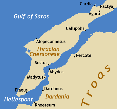
From the edge of the mound, look out across the plain toward the sea. In the Bronze Age the coastline was much closer. Over many centuries, rivers carried soil down and slowly filled an ancient bay. Today you see fields, farms and the distant water of the Dardanelles. That narrow strait connects the Aegean Sea with the Sea of Marmara. Whoever held this hill could watch the ships pass. That may be the simplest reason why so many cities rose here.
Near the entrance stands a large wooden horse. It is a modern replica, built for visitors, not an ancient object. Children love to climb inside and look out of the windows. It is a playful nod to the legend of the Greek soldiers hidden inside a horse. That tale belongs to myth and poetry, not to excavation records. Nearby, the modern Troy Museum displays many finds from the region, and it is worth a visit before or after your walk.
Before you leave, stop for a moment on the highest ground. Feel the wind again, and listen to the grass. Look down at the layers of stone beside the path, one age resting on another. Poets made this place larger than life. The hill itself is quieter and more human. Families lived here, cooked here, rebuilt their homes after disaster. As you walk back down, notice how the ground slopes gently away... from one city into the next.
Key facts
What to look for
Practical tips
Common questions
Is there a free audio guide to Hisarlik?
Yes — the Lokali app narrates Hisarlik free of charge in 50+ languages. The guide runs about 8 minutes, covers the history, what to look for on site and practical tips, and works offline once downloaded.
Where is Hisarlik?
Hisarlik is in Canakkale, Türkiye, at 39.9572, 26.2389. Tap the map link on this page for directions from where you are.
What is Hisarlik known for?
Archaeologists identify nine main city layers at Hisarlik. Oldest settlement dates to around 3000 BCE.
What should you look for at Hisarlik?
Sloping limestone walls of Troy Six near the path. Schliemann's deep trench cut through the mound. Curved stone seating of the Roman-era public building.
What should you know before visiting Hisarlik?
Bring water and a hat; the mound has little shade. Wear sturdy shoes for uneven stone paths and slopes.
When is the best time to visit Hisarlik?
Come early morning for cooler air and softer light.
On the map
Opens directions to Hisarlik from your location.
More to see in Canakkale



Hear Hisarlik in your language
The full story, narrated, in 50+ languages. Download it before you go and it plays offline, at your own pace, with no ticket and no tour group.