Mtirala National Park
41.6667° N · 41.8667° E · National Park
Mtirala National Park is a national park in Batumi, Georgia. One of Europe's wettest places, over four thousand millimetres of rain yearly. Ancient Colchian temperate rainforest, millions of years old. Most visitors spend 3-5 hours here. The free Lokali audio guide runs 6 minutes.
✓ Verified October 2026 · how we write these guides
Visitor facts
| Time needed | 3-5 hours |
|---|---|
| Lokali audio guide | 6 min · free |
| Type | National Park |
| Best for | Authentic finds |
| Location | Batumi, Georgia |
| Coordinates | 41.6667, 41.8667 |
| Languages | 45, in the Lokali app |
The story
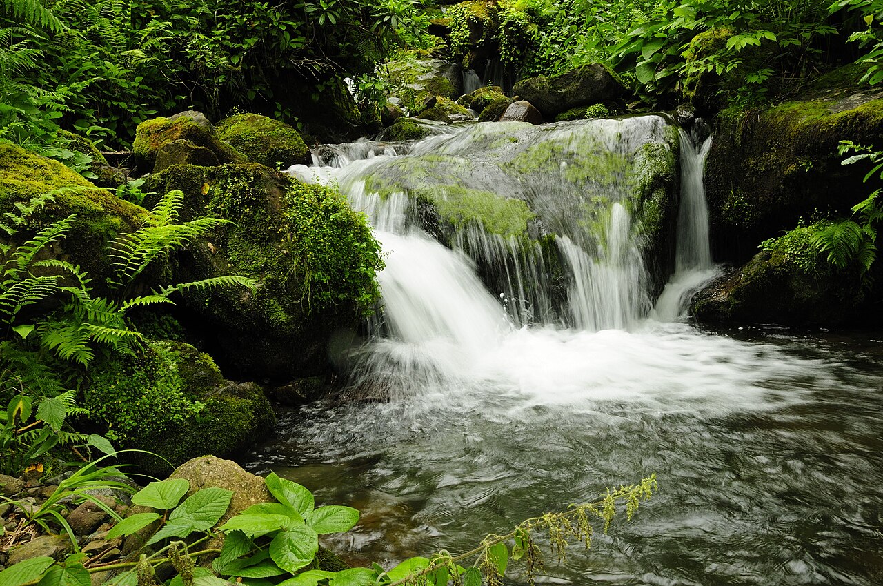
The air here is different. You can feel it the moment you step from the road into the forest — a cool, almost tangible weight of moisture on your skin, the scent of wet earth and moss so thick it tastes green. Mtirala means 'the weeping one' in Georgian, and the name is no exaggeration. This is one of the wettest places in all of Europe, receiving over four thousand millimetres of rain each year. The canopy above you drips even when the sky is clear, condensation falling from leaf to leaf in an endless quiet percussion.
You are standing in a remnant of the ancient Colchian forests that once covered the entire eastern Black Sea coast. These are temperate rainforests, a rare ecosystem in Europe, and the trees around you — hornbeam, chestnut, alder — have grown here in unbroken succession for millions of years. The understory is a tangle of rhododendron and laurel, their waxy leaves shedding water in silver beads. In spring, the forest floor erupts in wildflowers. In autumn, the air smells of fermenting chestnuts.
The park was established in two thousand and seven, protecting nearly sixteen square kilometres of steep forested ridges that rise from the Adjara lowlands toward the Lesser Caucasus. The topography is dramatic — narrow valleys cut by fast, cold streams, slopes so steep that trails switchback through the trees in tight zigzags. The highest point reaches just over fourteen hundred metres, and the climb from the visitor centre to the ridge is a study in shifting microclimates. You begin in subtropical warmth and end in cool montane mist.
Wildlife here is elusive but present. Brown bears move through the higher elevations in summer, feeding on berries and roots. Roe deer slip between the trees at dawn. Birdwatchers come for the Caucasian black grouse and the semi-collared flycatcher, both species found nowhere else on earth. The streams hold trout, and if you are quiet near the water at dusk, you might see an otter.
The main trail is a loop of roughly five kilometres, well-marked and maintained, though it can be slick after rain — which is to say, almost always. Wooden walkways span the wettest sections, their planks dark with algae. The path climbs steadily through beech and fir, crossing several small waterfalls that tumble over black basalt ledges. In places, the trail narrows to a single track between ferns taller than your head.
About halfway up, the forest opens onto a viewing platform. On clear days — rare, but worth the wait — you can see the Black Sea glinting to the west, a band of blue beyond the green ridges. More often, you will find yourself inside a cloud, the world reduced to the nearest trees and the sound of water moving somewhere below. The mist is not a disappointment here; it is the point. This is a place shaped by water, and the weather is part of the experience.
The park is home to over a thousand species of plants, many of them endemic to the Colchis region. The humid air and mild winters create conditions found almost nowhere else at this latitude. You will see ivy thick as a man's arm spiralling up oak trunks, and in the wettest pockets, sphagnum moss carpets the ground in pillows of vivid green. The biodiversity is staggering for such a small area.
Local guides sometimes lead night walks in summer, when the forest comes alive with sounds — the rasp of frogs, the distant call of owls, the rustle of nocturnal mammals in the leaf litter. It is a different place after dark, the trails lit only by headlamps, the trees pressing close. If you are lucky, you might catch the glow of bioluminescent fungi on a rotting log.
The visitor centre near the entrance offers basic maps and information, and there is a small guesthouse nearby if you want to stay overnight. Most visitors come as a day trip from Batumi or Kobuleti, but the park rewards those who linger. The forest changes hour by hour as the light shifts and the mist rolls in and out of the valleys.
Bring waterproof layers, even if the forecast is clear. The rain here is less a weather event than a constant presence, a soft drizzle that can turn to downpour without warning. Wear boots with good grip — the trails are mud and exposed roots, and footing is uncertain. A walking stick helps on the steeper sections.
As you walk back down toward the road, notice how the light filters through the canopy in shafts, catching the droplets that hang in the air. The forest is never silent here. Water moves everywhere — in the streams, in the leaves, in the soil beneath your feet. It is a place that asks you to slow down, to listen, to let the green weight of the air settle around you. When you leave, you will carry the smell of it with you for hours.
Key facts
What to look for
Practical tips
Common questions
How long do you need at Mtirala National Park?
Plan 3-5 hours. That is the time most visitors spend at Mtirala National Park. The free Lokali audio guide runs 6 minutes and is made to listen to while you walk.
Is there a free audio guide to Mtirala National Park?
Yes — the Lokali app narrates Mtirala National Park free of charge in 50+ languages. No ticket, tour group or subscription, and it works offline once downloaded.
Where is Mtirala National Park?
Mtirala National Park is in Batumi, Georgia, at 41.6667, 41.8667. Tap the map link on this page for directions.
What should you know before visiting Mtirala National Park?
Bring waterproof layers and sturdy boots with good grip
What is Mtirala National Park known for?
One of Europe's wettest places, over four thousand millimetres of rain yearly
What is the best time to visit Mtirala National Park?
Visit early morning for best chance of wildlife sightings
On the map
Opens directions to Mtirala National Park from your location.
More to see in Batumi


Hear Mtirala National Park in your language
The full story, narrated, in 50+ languages. Download it before you go and it plays offline, at your own pace, with no ticket and no tour group.