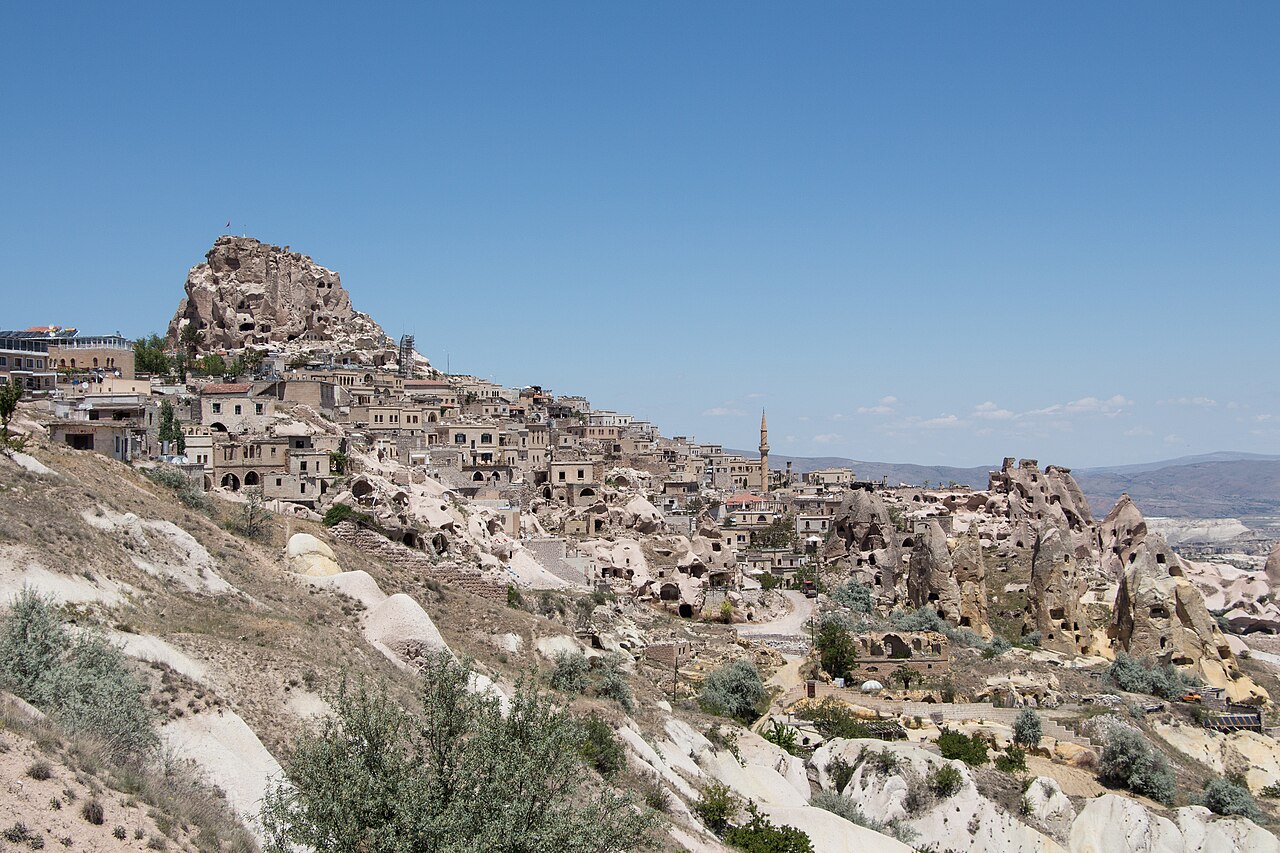
Uçhisar Castle is a rock fortress in Göreme, Türkiye. Summit is the highest viewpoint in the surrounding area. Name combines Turkish words for tip and fortress. Most visitors spend 1-1.5 hours here. The free Lokali audio guide runs 7 minutes.
✓ Verified October 2026 · how we write these guides
Visitor facts
| Time needed | 1-1.5 hours |
|---|---|
| Lokali audio guide | 7 min · free |
| Type | Rock Fortress |
| Best for | Photography |
| Location | Göreme, Türkiye |
| Coordinates | 38.6297, 34.805 |
| Languages | 45, in the Lokali app |
The story
Wind is the constant up here. It sweeps across the plateau, tugs at your jacket, and carries the smell of dust and dry grass. In front of you rises a single enormous rock, pale and pocked with hundreds of dark openings. Birds slip in and out of them. Stairways appear and vanish across its face. This is Uçhisar Castle — not a castle that was built, but one that was excavated. People did not raise walls here. They took a mountain of soft stone and hollowed it out.
The name combines Turkish words meaning tip and fortress — roughly, the fortress at the edge. The rock is the highest point in this part of Cappadocia, and the village of Uçhisar wraps around its base, old stone houses climbing partway up the slopes. From the summit, the view runs across the whole carved landscape — Göreme's valleys, ridges crowded with fairy chimneys, and on clear days the snow-streaked cone of Mount Erciyes far to the east — the volcano whose ancient eruptions created all this rock.
That origin story matters here more than anywhere. Volcanoes, including Erciyes and Hasan, buried the region in ash over millions of years. The ash compacted into tuff — a soft, light stone that carves easily but stands firm. Rain and wind stripped away the weaker layers, leaving towers, ridges, and this one giant block. Humans arrived and discovered the stone's secret: a room could be cut in days with simple iron tools. Entire villages moved into the rock instead of building on top of it.
For most of its history, this was a refuge. Cappadocia sat on the path of armies and raiders, and the region lay near contested frontiers for centuries. When danger approached, villagers withdrew into the rock. Narrow tunnels could be blocked from inside, and food and water were stored in carved chambers. From the summit, defenders could see trouble coming from many kilometres away. Uçhisar formed a lookout chain with other strongholds in the region, including a similar hollowed rock at Ortahisar nearby.
Hard dates are scarce here. The rock carries no founding inscription, and its rooms were recut so many times that archaeology struggles to untangle the layers. Written sources say little. What survives instead is the logic of the place — lookout, refuge, storehouse — repeated across centuries by people whose names are lost. That anonymity is typical of Cappadocia. Its greatest monuments were made by farmers with picks, not emperors with architects. Keep that in mind as you climb: every room was somebody's practical answer to weather, hunger, or war.
The rock's interior is a maze of chambers connected by stairs, shafts, and tunnels — homes, storerooms, cisterns, and dovecotes stacked without any master plan. Generations kept cutting new rooms as they needed them. Erosion and collapse have sealed some and exposed others; you will pass doorways that now open onto empty air. The climb to the top follows carved steps, reinforced and fitted with railings in modern times. Take it slowly and look into the side chambers as you go. Soot-darkened ceilings mark old kitchens and hearths.
The summit is a small platform with a Turkish flag and one of the widest views in central Anatolia. From up here, the landscape explains itself. You can trace how the valleys drain, and where softer rock has eroded into ravines. Villages sit on the ridges; orchards and vineyards take the valley floors. Balloons launch at dawn from the direction of Göreme, and in the evening the low sun turns the rock honey-coloured. Photographers prize both hours, and it is easy to understand why.
Below the castle on the Göreme side runs Güvercinlik — Pigeon Valley — named for the thousands of dovecotes carved into its cliffs. Farmers cut small chambers high in the rock, painted the entrances white to attract birds, and collected the droppings as fertilizer for vineyards and orchards. It was a whole quiet economy built on pigeons. Many dovecotes are still visible, and some are still visited by birds. A walking trail runs the length of the valley from Uçhisar down to Göreme — one of the region's most pleasant hikes.
The village deserves an hour of its own. Old Uçhisar climbs the lower slopes in tiers of stone houses — some abandoned, some carefully restored. In recent decades, restorers turned many cave houses into small hotels, and the village became a favourite of travellers who want quiet nights and long views. Lanes twist between courtyards; grapevines shade doorways. Tea houses on the terraces below the rock serve the view along with the glass.
Locals tell of tunnels running from the castle far out under the plateau — escape routes for times of siege. Some passages certainly exist; how far they reach is another question, and stories grow in the telling. Treat the longest versions as folklore. What is certain is the storage: chambers inside the rock held grain, oil, and water, enough to outlast a raid. The strategy was patience. Attackers in this dry country could rarely wait longer than defenders sitting on full cisterns.
Look up at the face of the rock from the base and read its surface. Openings mark rooms; grooves mark stairways; rows of small holes mark dovecotes. Weathering steadily peels the outer stone, which is why some sections are fenced off. The same softness that made the rock carvable makes it fragile. Whole outer rooms have sheared away over the centuries, leaving their back walls open to the sky. Respect the barriers — the mountain is still slowly changing shape.
End your visit at the summit rail, facing whichever direction the light favours. Under your feet is a hill that people have hollowed for well over a thousand years — sleeping in it, storing harvests in it, hiding in it, defending it. Now it shelters little more than pigeons and the wind. Listen to that wind for a moment — steady, patient, the same force that carved the valleys below. Then start down the stairs, toward the village and its tea terraces.
Key facts
What to look for
Practical tips
Common questions
How long do you need at Uçhisar Castle?
Plan 1-1.5 hours. That is the time most visitors spend at Uçhisar Castle. The free Lokali audio guide runs 7 minutes and is made to listen to while you walk.
Is there a free audio guide to Uçhisar Castle?
Yes — the Lokali app narrates Uçhisar Castle free of charge in 50+ languages. No ticket, tour group or subscription, and it works offline once downloaded.
Where is Uçhisar Castle?
Uçhisar Castle is in Göreme, Türkiye, at 38.6297, 34.805. Tap the map link on this page for directions.
What should you know before visiting Uçhisar Castle?
Climb at sunset for honey-coloured light across the valleys
What is Uçhisar Castle known for?
Summit is the highest viewpoint in the surrounding area
What is the best time to visit Uçhisar Castle?
Climb at sunset for honey-coloured light across the valleys
On the map
Opens directions to Uçhisar Castle from your location.
More to see in Göreme

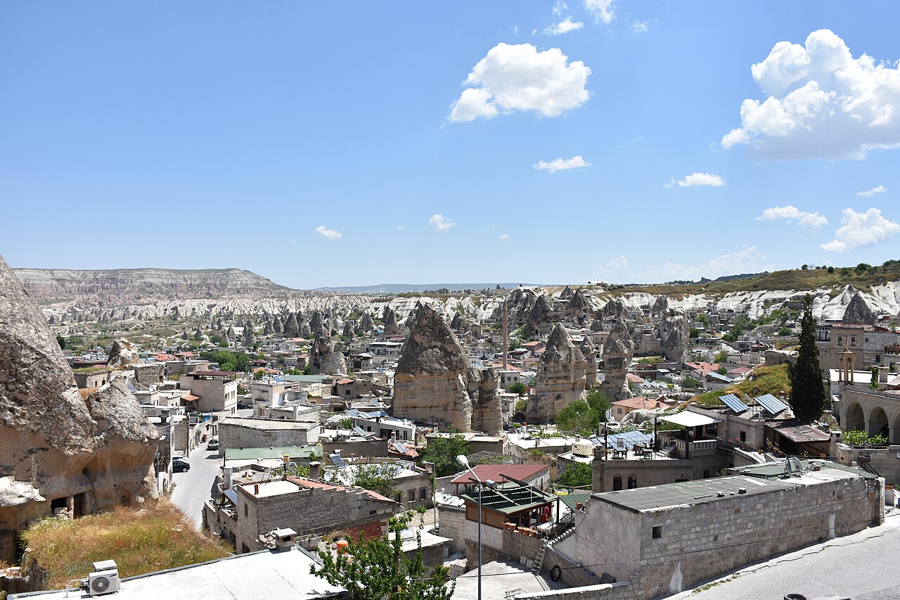


Hear Uçhisar Castle in your language
The full story, narrated, in 50+ languages. Download it before you go and it plays offline, at your own pace, with no ticket and no tour group.